Lonely Planet IcelandLonely Planet
Guidebook
Lonely Planet Iceland
Lonely Planet · 2026
Newest Lonely Planet edition: Ring Road planning, road and weather advice, and practical detail for every major Icelandic waterfall.

Iceland · Flóahreppur
Urriðafoss is a waterfall located in the river Þjórsá in southwest Iceland. With a flow rate of 360 m³/s, it has the highest average water flow of any waterfall in Iceland, and the second highest in Europe behind the Rheinfall.
Facts from Wikidata and Wikipedia, compiled September 2026; season and access are our estimate, not a visit report. How we build these pages.
Urriðafoss drops over a series of steps. It is a cascade-type fall, and the nearest base for a visit is Flóahreppur, Iceland. Access to the main viewpoint is rated moderate.
Summary adapted from the Wikipedia article (CC BY-SA 4.0).
As a cascade waterfall, water tumbles down a series of rock steps rather than falling free.
No commercial adventures run at Urriðafoss itself — the experience is the approach and the view. Guided day trips from Flóahreppur are the easiest way to combine it with the area around it.
Also good forHikingPhotography
Snowmelt feeds the falls from late May; June to August is the short, bright season, and many access roads close in winter.
 This waterfall
Urriðafoss
Iceland
Height—Width—
 Most similar
Langfoss
Norway
Height612 mWidth—
Also a cascade waterfall and in Norway
 Largest curtain
Victoria Falls
Zimbabwe · Zambia
Height108 mWidth1,708 m
Largest single sheet of falling water
 Tallest on earth
Angel Falls
Venezuela
Height979 mWidth—
 Widest on earth
Khone Phapheng Falls
Laos
Height21 mWidth10,783 m
Measured across the whole multi-channel system
We don't have a reliable crest width for Urriðafoss yet, so it is left off the width chart. Tallest · widest lists.
Guidebook
Lonely Planet · 2026
Newest Lonely Planet edition: Ring Road planning, road and weather advice, and practical detail for every major Icelandic waterfall.
Guidebook
Rough Guides · 2025
Current Rough Guide with region-by-region coverage of the south coast, Mývatn area, Snæfellsnes and Vatnajökull.

Guidebook
DK Eyewitness · 2024
Map-heavy illustrated guide, handy for picturing the Golden Circle and south-coast falls before you drive them.
Natural history
Thor Thordarson & Ármann Höskuldsson · 2022
Field geology of Iceland's volcanic landscapes, explaining the lava, basalt and canyons that shape falls like Svartifoss and Dettifoss.
63.92389, -20.67389
Urriðafoss is in Iceland (Flóahreppur). The nearest base is Flóahreppur, Iceland. Its coordinates are 63.9239, -20.6739.
Peak flow is June to August. Snowmelt feeds the falls from late May; June to August is the short, bright season, and many access roads close in winter.
Beyond the viewpoints: hiking and photography. Access to the main viewpoint is rated moderate — a real walk — expect stairs, uneven ground or an hour on the trail.
The usual base is Flóahreppur, Iceland. A real walk — expect stairs, uneven ground or an hour on the trail from there.
Nearby

The Faxi waterfall is located on the Golden Circle, a popular tourist trail approximately 120 km east of…

Brúarfoss is a waterfall in Iceland.

Þjófafoss aˌfɔsː] , "thieves' waterfall"; also Thjofafoss) is located on the river Þjórsá on the east side of…
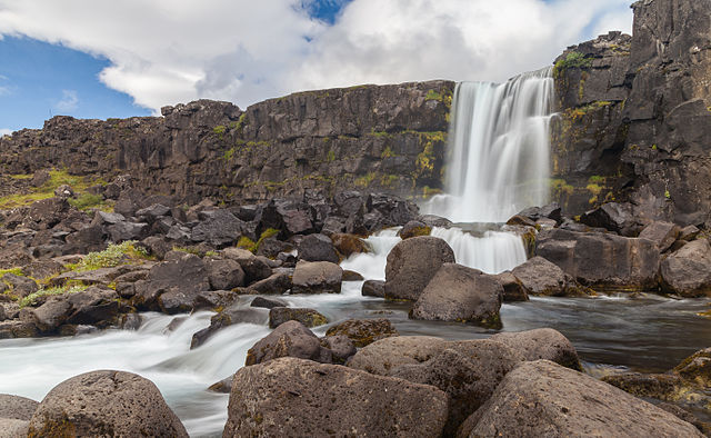
Öxarárfoss is a waterfall in Þingvellir National Park, Iceland. It flows from the river Öxará over the…