
Guidebook
Lonely Planet Norway
Lonely Planet · 2024
Current Lonely Planet covering the western fjords, Hardanger, Geiranger and Telemark roads past Norway's big falls.

Norway · Hordaland
A series of steep cascades tumbles almost the full height of a mountainside directly into Akrafjorden, visible from a roadside pull-off without any hike required. A small sandy beach and picnic area at the base make it one of the most relaxed fjord-waterfall stops on Norway western coast.
Checked September 2026 by David Bussell
Langfoss drops 612 metres (2,008 ft) on the Langfoss stream. It is a cascade-type fall, and the nearest base for a visit is Etne, with HAU the closest airport. Access to the main viewpoint is rated easy.
As a cascade waterfall, water tumbles down a series of rock steps rather than falling free.
No commercial adventures run at Langfoss itself — the experience is the approach and the view. Guided day trips from Etne are the easiest way to combine it with the area around it.
Also good forHikingPhotography
Spring snowmelt gives the fullest of its several dramatic drops down the fjordside cliff.
Entry: Free; roadside picnic area
 This waterfall
Langfoss
Norway
Height612 mWidth—
 Most similar
Cascade Blanche
France
Height640 mWidth—
Also a cascade waterfall, of similar height and in France
 Largest curtain
Victoria Falls
Zimbabwe · Zambia
Height108 mWidth1,708 m
Largest single sheet of falling water
 Tallest on earth
Angel Falls
Venezuela
Height979 mWidth—
 Widest on earth
Khone Phapheng Falls
Laos
Height21 mWidth10,783 m
Measured across the whole multi-channel system
Angel Falls is 1.6× taller than Langfoss. It drops 5.7× further than Victoria Falls (108 m). We don't have a reliable crest width for Langfoss yet, so it is left off the width chart. Tallest · widest lists.
 4:52
 2:46
 2:07
Chosen from YouTube; videos belong to their creators and play from YouTube's privacy-enhanced player.
Guidebook
Lonely Planet · 2024
Current Lonely Planet covering the western fjords, Hardanger, Geiranger and Telemark roads past Norway's big falls.

Guidebook
DK Eyewitness · 2024
Illustrated Norway guide, good for planning fjord drives such as Geiranger and Hardanger.
59.8441, 6.3399
Langfoss is in Norway (Hordaland). The nearest base is Etne and the closest airport is HAU. Its coordinates are 59.8441, 6.3399.
Langfoss drops 612 metres (2,008 feet). It is a cascade-type waterfall on the Langfoss stream.
Peak flow is May to July. Spring snowmelt gives the fullest of its several dramatic drops down the fjordside cliff.
Beyond the viewpoints: hiking and photography. Access to the main viewpoint is rated easy — a short walk or roadside viewpoint.
The usual base is Etne, and the closest airport is HAU. A short walk or roadside viewpoint from there. Free; roadside picnic area.
Nearby
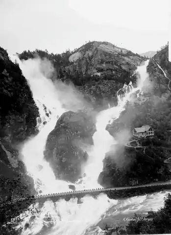
One of Norway's most photographed twin waterfalls

Tyssestrengene are waterfalls east of the village of Tyssedal in Ullensvang Municipality, in Vestland county…

Skrikjofossen is a waterfall in Ullensvang Municipality in Vestland county, Norway. The falls are located…

Steinsdalsfossen is a waterfall at Øvsthus in the eastern part of the village of Steine in Kvam Municipality…