
History & travel
The Yosemite
John Muir · 2003
Muir's own account of the valley, including his famous descriptions of Yosemite Fall and the Merced's Nevada and Vernal falls.

United States · California
Three linked drops totalling 739 metres off the north wall of Yosemite Valley, fed almost entirely by snowmelt. Thunderous in May, often bone dry by August, and the anchor of a valley with half a dozen more falls a shuttle ride away.
Full guide Checked September 2026 by David Bussell · 48 sources UNESCO World Heritage
Yosemite Falls is really three waterfalls stacked on one granite wall: Upper Yosemite Fall plunges 436 metres in a single free drop, the middle cascades tumble another 206 metres through a slot you barely see from below, and Lower Yosemite Fall finishes with a 98-metre drop into a boulder field. Together that is 739 metres, the tallest waterfall in the park. What makes it unusual is how completely it depends on snow. There is no glacier or lake behind it — Yosemite Creek drains the rim country to the north, so the falls roar in late spring and, in most years, shrink to a trickle or vanish by August.
You experience it from two very different levels. From the valley floor, the falls hang over Yosemite Village and Yosemite Valley Lodge, visible from half the meadows in the valley, and a flat one-mile loop takes you to the spray at the foot of the lower fall. Getting to the top is a different undertaking: a 7.2-mile round-trip climb with 2,700 feet of gain, switchbacking up the cliff beside the upper fall to the lip where Yosemite Creek goes over the edge.
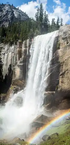
It is also the natural starting point for the rest of the valley's water. Bridalveil Fall, which flows all year, greets you at the western entrance; the Mist Trail climbs through the spray of Vernal and Nevada Falls on the Merced River; Ribbon Fall streaks down west of El Capitan for a few weeks each spring; and for a fortnight in February, Horsetail Fall catches the setting sun and glows orange — the 'firefall' that fills the valley's car parks. Add moonbows on spring full moons, a climbing school, raft floats and Glacier Point's view straight across at the whole system, and there is far more here than a single waterfall.
Stays in Yosemite National ParkFlights to FAT Where to stay ↓
Yosemite Village, Yosemite Valley Lodge and Curry Village, linked by the free shuttle
Almost every waterfall in the valley can be seen from the flat floor, and several can be reached on paved paths. The Lower Yosemite Fall loop takes thirty minutes and ends in the spray; Cook's Meadow frames the full three-tier drop; Bridalveil Fall is a ten-minute walk from its car park; and the footbridge below Vernal Fall is a short climb from Happy Isles. In February, the El Capitan Picnic Area becomes the viewing ground for Horsetail Fall's firefall.
Upper Yosemite Fall trail, the Mist Trail to Nevada Fall, and Glacier Point
The rim is where the scale of the valley's water actually registers. The Upper Yosemite Fall trail climbs 2,700 feet to the lip of the falls; the Mist Trail's granite staircase puts you beside Vernal Fall and then atop Nevada Fall. If you would rather not climb, Glacier Point — by car or tour bus when its seasonal road is open — looks straight across at Yosemite Falls and down on Vernal and Nevada from 3,200 feet above the valley floor.
Start on the valley floor — Lower Yosemite Fall, Cook's Meadow and Bridalveil take half a day and cost nothing beyond entry. If you are fit and it is spring, give a full day to one rim hike: Upper Yosemite Fall for the tallest drop, the Mist Trail for the wettest and most dramatic. Everyone else should get to Glacier Point once, by car or on the tour bus.
May is the classic month for full-volume falls, with April better in dry years and June in big-snow ones; come in mid to late February only if the Horsetail Fall firefall is the point of the trip.
Snowpack decides everything. Yosemite Falls is a snowmelt waterfall, so it can be a roaring torrent in May and a dry stain on the cliff by August — and in a low-snow year such as 2026, the peak comes weeks early and fades fast.
Every waterfall in the valley is running, most at full volume from late April into June. Lower Yosemite Fall throws spray across its footbridge, the Mist Trail earns its name, Ribbon Fall appears west of El Capitan, and spring full moons can set moonbows glowing in the spray. The catch: the high roads open gradually, and in a dry year like 2026 the peak can come in April and start fading before June.
The valley is busiest in July and August, just as its showpiece runs out of water. Yosemite Falls is typically a trickle or completely dry by August and stays that way until autumn storms. Bridalveil, Vernal and Nevada keep running at a fraction of their spring volume. This is the season for high country, Glacier Point and Tioga Road instead — with a real chance of wildfire smoke, as in September 2026.
Quiet, cold and often snowy. The first big storms can restart Yosemite Falls, and on freezing nights spray builds an ice cone at the base of the upper fall. In mid to late February, Horsetail Fall — which only runs in winter — can glow orange at sunset on clear evenings. Tioga and upper Glacier Point roads close, tyre chains may be required, and the valley has its lowest crowds of the year.
When a full or nearly full moon rises over the valley between roughly April and June and the falls are carrying heavy snowmelt, moonlight refracting through the spray can produce a faint, silvery lunar rainbow. Lower Yosemite Fall is the classic spot, reached on the paved loop from shuttle stop #6; Bridalveil Fall and the Mist Trail are alternatives. It needs clear skies, a low moon and plenty of water, so it is never guaranteed — and in a low-snow year like 2026, the water may be gone before the right moon arrives. Bring a headlamp, a tripod and a rain shell: the spray at the lower fall's footbridge soaks everything.
Prices are 2026 advertised rates in USD from the National Park Service, Yosemite Hospitality, YARTS and operator sites; hotel figures are advertised 'from' rates on booking sites unless stated, and move sharply with season, so treat them as a planning guide rather than a quote.
The easiest way to meet Yosemite Falls face to face: a flat one-mile loop with about 15 metres of gain, starting at shuttle stop #6, where there is no parking of its own. The eastern side is wheelchair-accessible when free of ice. In May the spray reaches the footbridge below the fall and the noise makes conversation difficult; by August you may find only wet rock. It is also the classic moonbow spot on spring full-moon nights.
Year-round; best April–June, when the fall is at full flow
No booking needed.
A historic trail climbing from Camp 4 (shuttle stop #7) in relentless switchbacks through oak woodland and then up steep, rocky granite beside the upper fall. Columbia Rock, a mile in and 1,000 feet up, is a good turnaround with a view down the valley. At the top, you look over the lip of the 436-metre drop. Carry four litres of water — there is none on the route — and add 1.6 miles for the view from Yosemite Point.
Year-round; icy or snow-covered near the top in winter
No booking needed.
The valley's wettest hike, starting at Happy Isles (shuttle stop #16). A paved climb reaches the Vernal Fall footbridge, then a long granite staircase climbs through the spray to the top of the 97-metre fall; carry on to the head of 180-metre Nevada Fall and return by the John Muir Trail for a loop. Repairs close the Mist Trail above Vernal Monday–Thursday, 7am–3:30pm, through October 2026 — take the John Muir Trail instead.
Year-round lower section; Mist Trail granite steps are closed in winter; weekday restrictions through October 2026
No booking needed.
The first waterfall most visitors see, pouring 190 metres off the south wall at the valley's western entrance. A short, largely accessible path, with about 24 metres of gain, climbs from the car park on Wawona Road to a viewpoint in the spray. Unlike Yosemite Falls, it keeps running through summer, and wind often blows its water sideways into the veil that gives it its name. The shuttle does not stop here and the car park fills early in summer.
Year-round — Bridalveil flows in all seasons
No booking needed.
For a few weeks each February, the low sun hits a thin winter-only fall on El Capitan's eastern edge and turns it deep orange for ten minutes or so. It needs water in the fall and a clear western sky; haze kills it. Viewing is from the El Capitan Picnic Area, about 1.5 miles each way on foot from Yosemite Falls parking, and one lane of Northside Drive becomes a pedestrian lane. Rules for 2027 are not yet announced — weekend reservations were required in 2024.
Mid–late February (10–26 February in 2026), clear evenings only
No booking needed.
A two-hour narrated circuit from Yosemite Valley Lodge, taking in Yosemite Falls, El Capitan, Half Dome, Bridalveil Fall and Tunnel View with a naturalist or ranger at the microphone. It won't get you close to any water, but it is the quickest way to learn which fall is which and how the glaciers carved the valley. Good on arrival day, for anyone who can't walk far, and in winter, when the heated coach beats standing in a meadow.
Year-round; open-air tram in warm months, heated coach in winter; moonlight tram on select summer nights
A bus from Yosemite Valley Lodge climbs 3,200 feet to Glacier Point, the one place where the whole waterfall system reads as a map: Yosemite Falls straight across the valley, Vernal and Nevada stacked on the Merced River below Half Dome. The one-way ticket is the smart hiker's option — ride up in the morning and walk back to the valley down the Panorama Trail past Illilouette and Nevada Falls, or down the steeper Four Mile Trail.
While Glacier Point Road is open, roughly late May to mid-October (to 12 October in 2026)
The full-day version for visitors without a car: Yosemite Valley, Glacier Point and the Mariposa Grove of giant sequoias in one loop from Yosemite Valley Lodge, with lunch included. You trade freedom for convenience — timings are fixed and the stops are short — but it covers ground that would otherwise take two days and a lot of parking. Check the route in late 2026: the Dome Fire near Wawona was affecting the south of the park at the time of writing.
9 May – 12 October 2026
Yosemite is the birthplace of big-wall climbing, and the park's own school has taught beginners here since 1969. This introductory day covers belaying, basic ropework and rappelling, and then a lot of climbing on real granite — aimed at complete beginners and gym climbers new to rock. Classes meet at Curry Village, and later classes build on this one if you catch the habit. Afterwards, look up at El Capitan with a very different respect.
Mainly spring to autumn; confirm dates with the school
Pay on the day — nothing to book in advance.
Not whitewater: a lazy self-guided float down the Merced from Curry Village to Sentinel Beach, with Yosemite Falls, Half Dome and Sentinel Rock sliding past overhead. Rentals are sold in person only from 8am at the Curry Village desk, first launch 10am, last tickets 1:30pm. The stand only opens once snowmelt drops and warms enough to be safe, and some years the window is short or never comes. Not recommended for non-swimmers.
Typically June–July, only when river level and temperature allow; listed closed in late September 2026
Pay on the day — nothing to book in advance.
The same snowmelt that powers the falls turns the Merced below the park into a Class III–IV river. The day trip runs 16 miles just outside the Arch Rock entrance on Highway 140, with big wave trains at peak melt in mid-May to early June and a splashier, more family-friendly character later. It is short-season and entirely snow-dependent — in a dry year like 2026, the window closes early.
Late April to mid-June, sometimes into July after a big snow year
Doing this one? Check your travel insurance covers adventure activities before you go — SafetyWing is one option.
Yosemite Falls is routinely billed as North America's tallest waterfall. It isn't: British Columbia's James Bruce Falls is measured at 840 metres, and Backpacker ranks Yosemite Falls sixth within the United States. The National Park Service says only that it is one of the world's tallest and the tallest in the park — which is still accurate. The more practical warning is seasonal. The falls run on snowmelt alone, and in most years they are a trickle or entirely dry by August, the valley's busiest month. In 2026, after a near-record-low snowpack and a record-warm March, the peak came in April and the falls had dried up by late September. If Yosemite Falls is the reason for your trip, come between April and June and check the snowpack news before you book.
Sleeping inside the valley means walking to the falls at dawn and after the day-trippers leave; everything outside it trades that for lower prices and a 30-minute to 90-minute drive each way — and note that the historic Wawona Hotel has been closed since December 2024 with no reopening date.
The park's 1927 grand hotel, a National Historic Landmark of stone and timber beneath the Royal Arches. Book a Prime View room specifically for a view of Upper Yosemite Fall, Half Dome or Glacier Point — standard rooms face the back.
The closest bed to Yosemite Falls — a short walk to the Lower Yosemite Fall loop — and the departure point for the Valley Floor, Glacier Point and Grand tours. Motel-style blocks, a pool, bike rental stand and food court.
Canvas tent cabins, heated and unheated, plus wooden cabins and Stoneman House rooms. The nearest lodging to Happy Isles and the Mist Trail, and home to the climbing school and raft desk. Closed 29 November – 10 December 2026.
Pines sites release on recreation.gov five months ahead, on the 15th at 7am Pacific, and sell out in minutes; only Upper Pines stays open all year. Camp 4, the climbers' campground at the Upper Yosemite Fall trailhead, books one week ahead in season.
A large riverside lodge on the Merced just outside the Arch Rock entrance — the closest sizeable hotel to the valley outside the park, on the year-round Highway 140 corridor that YARTS buses serve.
A modern resort half a mile from the park's Highway 120 west entrance, with lodge rooms and villas, a spa and a pool. The lodge quotes about 30 minutes to Yosemite Valley; allow longer in summer traffic. The natural base if you are driving in from the Bay Area.
A large resort just outside the South Entrance, close to the Mariposa Grove and on the Fresno side of the park — convenient after a flight into FAT, but a drive of well over an hour to the valley floor.
A hillside hostel-and-cabin complex between Mariposa and El Portal with an on-site restaurant and a YARTS stop at the entrance — the standard base for backpackers and anyone reaching the park by bus rather than car.
Search all Yosemite National Park accommodation
About 95 miles / 2.5 hours to Yosemite Valley via Highway 41 and the South Entrance. Nonstops from about a dozen US cities including Denver, Dallas, Phoenix, Las Vegas, Los Angeles, San Francisco, Seattle and Salt Lake City, plus Mexico. The practical closest gateway.
About 83 miles / 2 hours via Highway 140 — slightly closer than Fresno, but tiny: Contour Airlines began daily flights to Los Angeles and five weekly to Las Vegas on 1 July 2026. YARTS runs year-round from Merced to the valley.
About 193 miles / roughly 4 hours by car via Highway 120 or 140. The main long-haul international gateway, and usually the cheapest overall once you include international fares.
About 174 miles / roughly 3.5 hours by car. A Bay Area alternative with mostly domestic routes and an easier exit east.
About 200 miles / roughly 3.75 hours by car. Worth comparing against SFO for South Bay or domestic arrivals.
About 176 miles / roughly 3.5 hours by car via Highway 120. Useful for domestic flights, and for combining Yosemite with Lake Tahoe or the Sierra foothills.
San Francisco (SFO) is the realistic hub for international travellers; Fresno (FAT) is the closest airport with meaningful domestic choice and the best option if you'd rather fly than drive four hours.
YARTS buses run year-round on Highway 140 from Merced (Amtrak station) through Mariposa, Midpines and El Portal to the valley; the Highway 41 (Fresno), Highway 120 west (Sonora) and Mammoth routes are summer-only and end in late September. 2026 adult round-trip fares are $44 from Merced, $24 from Mariposa, $40 from Fresno and $60 from Mammoth, booked online. YARTS states that park entrance and nonresident fees are not included — non-US residents should budget the $100 per person either way. Inside the valley, the free Valleywide shuttle runs roughly 7am–10pm; park once and ride it, as trailhead car parks fill by mid-morning from spring to autumn.
US entry rules and fees have changed repeatedly through 2025–2026, and the $250 visa integrity fee was still being rolled out unevenly in mid-2026 — check the official CBP and State Department sites before you book, not a third-party agent.
 This waterfall
Yosemite Falls
United States
Height739 mWidth—
 Most similar
Kjelfossen
Norway
Height755 mWidth—
Also a tiered waterfall and of similar height
 Largest curtain
Victoria Falls
Zimbabwe · Zambia
Height108 mWidth1,708 m
Largest single sheet of falling water
 Tallest on earth
Angel Falls
Venezuela
Height979 mWidth—
 Widest on earth
Khone Phapheng Falls
Laos
Height21 mWidth10,783 m
Measured across the whole multi-channel system
Angel Falls is 1.3× taller than Yosemite Falls. It drops 6.8× further than Victoria Falls (108 m). We don't have a reliable crest width for Yosemite Falls yet, so it is left off the width chart. Tallest · widest lists.
 4:32
 2:27
 9:33
Chosen from YouTube; videos belong to their creators and play from YouTube's privacy-enhanced player.
History & travel
John Muir · 2003
Muir's own account of the valley, including his famous descriptions of Yosemite Fall and the Merced's Nevada and Vernal falls.

Walking guide
Suzanne Swedo · 2019
Trail-by-trail guide devoted entirely to Yosemite's waterfalls, with maps, distances and best seasons for each fall.
Guidebook
Ann Marie Brown · 2024
Current park guide with trail descriptions for the Mist Trail, Upper Yosemite Fall and Bridalveil, plus lodging and permits.
Guidebook
Lonely Planet · 2024
Latest Lonely Planet park guide covering Yosemite Valley's waterfall hikes, shuttles, camping and when the falls run highest.
No. The National Park Service did not require entry or peak-hours reservations at any point in 2026, including summer and the February Horsetail Fall viewing period. You still need to book lodging, campsites, Half Dome permits and wilderness permits. Reservation systems have come and gone in recent years — weekend reservations were required in February 2024 — so check again before a 2027 trip.
From 1 January 2026, non-US residents aged 16 or over pay a $100 nonresident fee each, on top of the standard $35 vehicle fee. A family of four adults in one car therefore pays $435. The alternative is the $250 America the Beautiful nonresident annual pass, which waives the per-person charge. Children under 16 pay nothing, and payment is by card only.
Usually from August until the first big autumn or winter storms, though in dry years the flow falls away earlier — it was listed as dry in late September 2026 after a near-record-low snowpack. It runs strongest in May, sometimes April or June depending on the snow. Bridalveil Fall is the only valley waterfall that reliably flows year-round.
No, despite the claim appearing everywhere. At 739 metres, it is the tallest waterfall in Yosemite and one of the tallest in the world, but British Columbia's James Bruce Falls is measured at 840 metres, and several US falls, including Hawaii's Olo'upena, are ranked higher. It is one of the most visible very tall waterfalls on the continent.
The Upper Yosemite Fall trail is 7.2 miles round trip with 2,700 feet of elevation gain, and takes most hikers six to eight hours. It starts near Camp 4 (shuttle stop #7). Columbia Rock, one mile and 1,000 feet up, makes a two-to-three-hour turnaround. Carry about four litres of water, as there is none on the trail.
Horsetail Fall glows at sunset in mid to late February; the park's 2026 viewing period ran 10–26 February, with no reservation required. It only happens on clear evenings when the fall has water. Viewing is at the El Capitan Picnic Area, about 1.5 miles' walk from Yosemite Falls parking. The rules for February 2027 had not been announced at the time of writing.
Merced (MCE), at about 83 miles, is technically closest, but it only has Contour Airlines flights to Los Angeles and Las Vegas. Fresno (FAT), about 95 miles and 2.5 hours away, has far more routes and is the practical choice. International visitors usually fly into San Francisco and drive about four hours, or take Amtrak to Merced and connect to YARTS.
Yes. The falls are visible from much of the valley floor, including Yosemite Valley Lodge, Cook's Meadow and Yosemite Village. The Lower Yosemite Fall loop is flat and partly wheelchair-accessible, and takes about thirty minutes. For the whole three-tier drop from above, drive or take the tour bus to Glacier Point when its seasonal road is open.
Yosemite Falls is in United States (Sierra Nevada, California), inside Yosemite National Park. The nearest base is Yosemite Valley and the closest airport is FAT. Its coordinates are 37.7566, -119.5969.
Prices, fees and entry rules change. We re-check full guides regularly; spotted something out of date? Tell us.
Nearby
 UNESCO
One of Yosemite's most-hiked destinations

Snow Creek Falls is a long series of cascades located in Yosemite National Park toward the eastern extent of…
 UNESCO
Yosemite's most reliably year-round waterfall
 UNESCO
Upper anchor of Yosemite's famous Mist Trail