Hiking Waterfalls in OregonAdam Sawyer
Walking guide
Hiking Waterfalls in Oregon
Adam Sawyer · 2014
Waterfall-specific hiking guide covering Multnomah and the dozens of other Gorge falls within a short drive.

United States · Oregon
A 189-metre, two-tier drop off the basalt wall of the Columbia River Gorge, half an hour from Portland's airport. Oregon's most-visited natural site, and the anchor of a waterfall corridor you can drive, bus or hike in a day.
Full guide Checked September 2026 by David Bussell · 37 sources
Multnomah Falls drops 620 feet (189 metres) in two stages down a cliff of stacked Columbia River basalt, the layered lava flows that built the Oregon side of the Gorge. The upper fall does almost all the work, plunging roughly 165 metres into a pool hidden in a rock amphitheatre; the lower fall spills another 21 metres or so to the creek. Multnomah Creek is fed by springs, rain and snowmelt off Larch Mountain, so unlike Yosemite's snowmelt falls it runs all year — heaviest from late autumn to spring, thinnest in late summer.
The layout is compact and vertical. From the I-84 car park at Exit 31 you walk under the freeway and railway to a stone plaza beside the 1925 Multnomah Falls Lodge, where the whole two-tier drop stands in front of you. A paved path climbs a few hundred metres to the Benson Bridge, the 1914 concrete footbridge that spans the gap between the two tiers — the postcard shot, seen from below. Beyond it, eleven switchbacks climb to a platform at the lip of the upper fall, and the Larch Mountain Trail carries on up Multnomah Creek past two more waterfalls.
What makes it a destination rather than a freeway stop is what sits either side. The Historic Columbia River Highway, opened in stages from 1916, strings together Latourell, Bridal Veil, Wahkeena, Horsetail and Elowah Falls within about 20 km, with Vista House perched on Crown Point at the western end. Loop trails link several of them, a hop-on trolley runs the corridor in summer, and across the river in Washington, Panther Creek Falls and the lodges around Stevenson give you a second day. You can do the corridor from Portland without a car — or, better, spend a night in Cascade Locks or Hood River and be first at the falls.
I-84 Exit 31 or the Historic Columbia River Highway, between Corbett and Cascade Locks
Most visitors never get past the plaza, and it is a fine view: the full two-tier drop framed by the Benson Bridge, with the stone lodge, restaurant, snack bar and a small Forest Service visitor centre beside it. Ten minutes up a steep paved path puts you on the bridge itself, between the tiers in the spray. Keep climbing for about 45 minutes and you stand on a platform at the lip of the upper fall, looking down on the lodge roof and the Columbia beyond.
US 30 from Crown Point to Ainsworth State Park, via Latourell, Bridal Veil, Wahkeena, Horsetail and Elowah Falls
The 1916 highway winds along the base of the cliffs with a waterfall every few kilometres. Latourell's 76-metre ribbon is a two-minute walk from its car park; Bridal Veil is a short, steep walk down; Wahkeena sits a kilometre west of Multnomah and links to it by a loop trail; Horsetail pours beside the road, with Ponytail Falls — which you walk behind — just above. Vista House on Crown Point gives the big view up the Gorge. Oneonta Gorge's creek walk remains closed.
Stevenson and Carson, across the Bridge of the Gods from Cascade Locks
Cross the Bridge of the Gods and the Gorge looks back at Oregon's cliffs. Stevenson has Skamania Lodge and the Columbia Gorge Interpretive Center; north of Carson, a forest road leads to Panther Creek Falls, where a short trail drops to a viewing deck over a wide, braided fall fed by side springs. It is quieter than anything on the Oregon side, though the forest road is gravel in places and snow can close it in winter.
Give Multnomah Falls itself two to three hours and climb at least to the Benson Bridge; the top platform is worth it if you can manage 11 switchbacks. Then spend the rest of the day on the Historic Highway — Wahkeena, Horsetail and Latourell are all better experiences than their fame suggests. The Washington side is for a second day, not a substitute.
March to May gives the fullest flow without the summer permit system; October and November trade a little water for autumn colour and empty weekday mornings, and winter only rewards those ready to turn back when the ice arrives.
Rain, not snow, sets the flow. Multnomah Creek runs all year, strongest from November to May and thinnest in August and September — but the bigger practical variable is summer crowding and the timed-use permit season, which in 2026 ran from 22 May to 7 September.
The falls are at or near full volume, the basalt walls are streaked with seasonal waterfalls that dry up later, and the woods along Wahkeena and Larch Mountain trails are green and dripping. Crowds build from late March, especially on weekends and spring-break weeks, but there are no permits until late May. Expect rain on many days and muddy, slippery trails above the Benson Bridge.
Dry, warm and at its busiest. The flow drops but the upper fall still runs. Cars at the I-84 lot need a $2 timed-use reservation between 9am and 6pm, and the lot still fills; bus riders, walkers and cyclists are exempt. Gray Line's Waterfall Trolley and Portland tours run their season. Late summer brings wildfire risk, fire restrictions and the chance of smoke or sudden closures.
Once the permit season ends, you can drive in without booking, and weekday mornings are calm. Flow is lowest in September, then rebuilds as the rains return in October and November, when big-leaf maples turn yellow along the corridor. Days shorten fast; be off the upper trail by dusk. The lodge restrooms are under renovation until November 2026, with portable toilets in the meantime.
High flow, few people and, during cold snaps, the Gorge's east wind can freeze the spray into an ice shell around the falls and the Benson Bridge. The same storms bring ice and snow that can shut I-84, the Historic Highway and the trail above the bridge. Vista House keeps reduced hours, closing when winds top 50 mph.
A few times a winter, when an Arctic outflow pours down the Gorge from the east, Multnomah Falls partly freezes: spray coats the Benson Bridge and the cliff in ice and the upper fall runs inside a column of icicles. It never freezes solid, and the conditions that make it happen are exactly the ones that close roads — freezing rain, 50 mph gusts and black ice on I-84. Check ODOT TripCheck before setting out, carry traction devices, and expect the paved path beyond the plaza to be closed.
Prices are 2026 advertised rates in USD from ODOT, the Forest Service, Oregon State Parks, Columbia Area Transit and tour operators' own sites; hotel figures are advertised 'from' rates on booking sites (Kayak, momondo, Priceline) and move with season, so treat them as a planning guide rather than a quote.
The essential visit. The plaza by the lodge gives the full 189-metre, two-tier view; a steep paved path then climbs about 400 metres to the Benson Bridge, built in 1914 by timber magnate Simon Benson, which spans the gap between the tiers so you stand directly beneath the upper fall's spray. In spring the bridge is wet and loud. The plaza and lodge are wheelchair-accessible; the path to the bridge is paved but steep.
Year-round; path above the plaza can close for ice
No booking needed.
From the Benson Bridge, the paved Larch Mountain Trail climbs 11 switchbacks through the forest to a ridge, then drops to a railed platform at the lip of the upper fall, where you look straight down 165 metres to the pool and the lodge roof. The Forest Service calls the climb the equivalent of 60 flights of stairs; hiking guides measure more. It is busy all day in summer — start before 9am for space on the platform.
Year-round; icy in cold snaps
No booking needed.
The best half-day hike in the corridor. Start at Wahkeena Falls, climb its switchbacks past Fairy Falls, cross the ridge, and descend Multnomah Creek past Ecola and Wiesendanger Falls to the top of Multnomah and down to the lodge; a short walk along the Historic Highway closes the loop. You see five or six waterfalls and escape the crowds in the middle section. Avoid it within 48 hours of heavy rain, when fire-scarred slopes shed rock and trees.
Year-round; best March–May
No booking needed.
The serious option: Trail #441 follows Multnomah Creek from the falls all the way to the Larch Mountain day-use area, gaining roughly 1,200 metres, with Sherrard Point's rocky summit looking out over Mount Hood, Mount St Helens, Mount Adams and Rainier on clear days. Strong hikers can arrange a car shuttle at the top — but Larch Mountain Road is gated at milepost 10 from November until late May or June.
Late spring to autumn; upper trail snow-dependent
No booking needed.
An open-air trolley that loops the Historic Highway from Corbett, with ten stops including Vista House, Latourell, Bridal Veil, Angels Rest, Wahkeena, Multnomah Falls, Triple Falls, Horsetail and Ainsworth. Loops run hourly from about 9am to a last departure at 4pm, so you can hike a loop and catch the next one. Free parking at the Corbett fire station, or arrive on the Columbia Gorge Express and board at Multnomah Falls.
Summer season (to mid-September in 2026)
A narrated coach from Director Park in downtown Portland to Multnomah Falls, where you pick up an all-day Waterfall Trolley pass and explore the corridor on your own before the coach home. Gray Line also sells a 2.5-hour Multnomah Falls Express (9am and 1:30pm) with an hour at the falls, and a longer day at Multnomah only. Good value if you have no car; seasonal and not daily.
Thursday–Sunday, 23 May – 13 September in 2026
Small-group (up to 12) guided tour from downtown Portland along the Historic Columbia River Highway: Vista House at Crown Point, Latourell Falls, Horsetail Falls and Multnomah Falls, with morning and afternoon departures. The route sometimes runs in reverse to dodge crowds. Wildwood also sells a full-day Gorge and Mount Hood version from $149. The practical choice outside Gray Line's summer season.
Year-round
An afternoon tour for up to ten, with pick-up from downtown Portland hotels: Latourell and one or two other corridor falls, Multnomah Falls, then a boutique winery in the Hood River Valley for tastings. The operator covers permits, drinks and entry fees. More expensive than the bus tours, but it adds the east Gorge's wine country and gets you home without driving after tastings.
Year-round
A 1918 domed stone rest stop perched 211 metres above the Columbia at the western gateway to the corridor, built as the showpiece of the Historic Highway. The terrace gives the classic view east up the Gorge; inside are a small museum, gift shop and, downstairs, a volunteer-run coffee counter. It closes when winds top 50 mph — which on Crown Point happens more than you would expect.
Year-round, Friday–Monday; winter hours 10am–4pm
No booking needed.
The westernmost of the corridor falls, a 76-metre single plunge down a wall of columnar basalt splashed with yellow-green lichen. A paved path reaches the viewpoint in minutes; the loop trail continues up past Upper Latourell Falls and back down through the forest. Since 30 March 2026, the Guy W. Talbot State Park trailhead requires a state parks day-use permit.
Year-round
Pay on the day — nothing to book in advance.
Horsetail Falls fans out right beside the Historic Highway. The trail climbs switchbacks behind it to Ponytail Falls, where the path runs through a basalt overhang directly behind the curtain of water. Continue to the Oneonta Creek crossing and up to Triple Falls, a three-pronged drop above the gorge. The creek-bed scramble up Oneonta Gorge itself is closed by Forest Service order until 17 July 2027.
Year-round
No booking needed.
A short trail on the Washington side, north of Carson in the Gifford Pinchot National Forest, dropping to a viewing deck over a broad, multi-strand fall where Panther Creek and a side spring pour into a mossy bowl. Take the Wind River Highway north from Carson, then Forest Road 65; the turnout is poorly signed. A good reason to stay at Skamania Lodge, and quiet when Multnomah is packed.
Spring to autumn; forest road may be snowbound in winter
No booking needed.
The 2026 timed-use permit season for the I-84 lot ended on 7 September, and ODOT says 2027 rules will be posted on its site and Recreation.gov — expect a similar late-May-to-early-September system, but do not assume it. A permit never guaranteed a space, and the lot still fills on sunny weekends. Separately, the 2017 Eagle Creek Fire, which burned nearly 50,000 acres of the Oregon side, still shapes access: Oneonta Gorge is closed until 17 July 2027, several backcountry trails remain closed, and the Forest Service warns hikers to avoid burned slopes within 48 hours of heavy rain because of rockfall and landslides. Eagle Creek Trail was also reported closed into October 2026 after a rockfall near Punch Bowl Falls. Check the Forest Service alerts page before you go.
Multnomah Falls Lodge is a restaurant and visitor centre with no guest rooms, so you sleep in Portland or Troutdale to the west, Cascade Locks 20 km east, Hood River 50 km east, or across the river in Stevenson — the closer you stay, the easier it is to be at the falls before the car park fills.
A big timber resort above the river with lodge rooms, treehouses, glamping tents and cabins, a spa, indoor pool, a nine-hole short course and Skamania Adventures' ziplines and aerial course. About 30 minutes from Multnomah Falls via the Bridge of the Gods.
A 1921 clifftop hotel on the west edge of Hood River, with gardens running to the rim above the Columbia and its own waterfall on the grounds. Restaurant and full spa; about 40 minutes east of Multnomah Falls.
The closest chain hotel to the corridor, on the river beside the Bridge of the Gods, about 20 minutes from Multnomah Falls. The Columbia Gorge Express stops in Cascade Locks, and the town's brewpubs are a short walk away.
A riverside hotel at the foot of the Hood River bridge, practical for combining the waterfall corridor with Hood River's wineries, orchards and kiteboarding beach, and for crossing to the Washington side. About 40 minutes from Multnomah Falls.
A newer chain option in Hood River with breakfast included — dependable if the historic properties are full. Handy for the Columbia Gorge Express, which terminates at the Hood River transit centre.
A historic brick hotel on Oak Street in downtown Hood River, within walking distance of restaurants, taprooms and the waterfront. Character over space: rooms vary a lot in size, and the brick walls and creaking floors are part of the deal.
A sprawling former county poor farm turned into a hotel with its own brewery, winery, bars, gardens, soaking pool and summer concerts. Troutdale is the western gateway to the Historic Highway, about 25 minutes from Multnomah Falls and 20 from PDX.
A small, simple motel in Cascade Locks listed among lodging by the Columbia Gorge Express stop. Worth a look for hikers who want the shortest drive to the corridor trailheads at the lowest cost.
Search all Hood River, Oregon accommodation
About 45 km / 28 miles west of Multnomah Falls, 35 minutes by car on I-84. Nonstops across the US plus British Airways to London Heathrow, KLM to Amsterdam, Condor (seasonal) to Frankfurt, Icelandair (seasonal) to Reykjavík, and flights to Vancouver, Toronto and Mexico. The MAX Red Line runs from the terminal to Gateway Transit Center, where the Columbia Gorge Express starts.
About 300 km / 190 miles north, roughly 3.5 hours by car. Far more long-haul choice (Asia, Europe, the Middle East); worth it if it saves a connection, then drive or take the train to Portland.
Portland (PDX) is the realistic gateway — small, efficient and connected to the Gorge by light rail and bus; Seattle (SEA) is the long-haul fallback, especially from Asia.
Driving: the main lot sits in the median of I-84, reached by left-lane exits at Exit 31; a pedestrian underpass leads to the lodge. From late May to early September (22 May – 7 September in 2026), cars need a $2 timed-use reservation on Recreation.gov between 9am and 6pm, released 14 days and 2 days ahead at 7am Pacific; a few free same-day permits are handed out at the Gateway to the Gorge Visitor Center in Troutdale and the Cascade Locks Historical Museum. The small Historic Highway lot opposite the lodge is run by Sasquatch Shuttle and charges up to $20. Without a car: take the Columbia Gorge Express from Gateway Transit Center in Portland (about 30 minutes; $10 day pass; seven to nine trips a day), which needs no permit — though in extreme congestion it occasionally skips the Multnomah Falls stop. Sasquatch Shuttle also runs $5 per person from the Troutdale outlets.
US entry rules and fees have changed repeatedly through 2025–2026, and the $250 visa integrity fee was still being rolled out unevenly in mid-2026 — check the official CBP and State Department sites before you book, not a third-party agent.
 This waterfall
Multnomah Falls
United States
Height189 mWidth—
 Most similar
Chilnualna Falls
United States
Height212 mWidth—
Also a tiered waterfall, of similar height and in the United States too
 Largest curtain
Victoria Falls
Zimbabwe · Zambia
Height108 mWidth1,708 m
Largest single sheet of falling water
 Tallest on earth
Angel Falls
Venezuela
Height979 mWidth—
 Widest on earth
Khone Phapheng Falls
Laos
Height21 mWidth10,783 m
Measured across the whole multi-channel system
Angel Falls is 5.2× taller than Multnomah Falls. It drops 1.8× further than Victoria Falls (108 m). We don't have a reliable crest width for Multnomah Falls yet, so it is left off the width chart. Tallest · widest lists.
 2:37
 19:41
 1:14
Chosen from YouTube; videos belong to their creators and play from YouTube's privacy-enhanced player.
Walking guide
Adam Sawyer · 2014
Waterfall-specific hiking guide covering Multnomah and the dozens of other Gorge falls within a short drive.
Walking guide
Gregory A. Plumb · 2013
Catalogues hundreds of falls in Oregon, Washington and Idaho with access notes, ideal for chaining several falls into one trip.

Walking guide
Scott Cook · 2010
Local favourite guide to Columbia River Gorge hikes and waterfalls on both the Oregon and Washington sides.
Guidebook
Matt Wastradowski · 2023
Statewide Oregon guide with Columbia River Gorge coverage, the Historic Columbia River Highway and nearby towns.
Only if you drive to the I-84 lot between 9am and 6pm in summer. In 2026 the timed-use reservation ran from 22 May to 7 September and cost $2 per vehicle on Recreation.gov. Outside those dates and hours, no permit is needed. Bus riders, walkers, cyclists and tour passengers never need one. ODOT has not yet published 2027 dates.
About 2.4 miles (3.9 km) return on a paved trail with 11 switchbacks, from the lodge past the Benson Bridge to a platform at the lip of the upper fall. Allow 1.5 to 2 hours. The Forest Service likens it to climbing 60 flights of stairs; hiking guides put the gain higher. Just the Benson Bridge is a 10-minute walk from the plaza.
Yes. The Columbia Gorge Express runs from Gateway Transit Center in Portland — reached by the MAX Red Line from the airport or downtown — to Multnomah Falls in about 30 minutes, seven to nine times a day, for a $10 day pass. In summer, Gray Line's Waterfall Express and Waterfall Trolley cover the wider corridor, and several operators run year-round tours.
No. The 1925 stone lodge houses a restaurant, snack bar, gift shop and Forest Service visitor centre, but no guest rooms. The nearest hotels are in Cascade Locks, about 20 minutes east, and Troutdale, about 25 minutes west; Hood River and Stevenson, Washington, have the widest choice within 40 minutes.
Partly, during cold snaps when an east wind blows down the Gorge. Spray builds ice on the cliff, the pool and the Benson Bridge, and the upper fall can run inside an icicle column, but it never stops flowing. The same weather can close I-84, the Historic Highway and the trail above the bridge, so check TripCheck and the Forest Service alerts first.
No. The Forest Service's Eagle Creek Fire area closure covers the creek bed of Oneonta Gorge between the Historic Highway and the Horsetail Falls Trail bridge, effective from 17 July 2026 to 17 July 2027 unless lifted earlier. You can still see Horsetail, Ponytail and Triple Falls on the Horsetail Falls Trail, which crosses Oneonta Creek above the closed section.
March to May, when the creek runs high, the cliffs sprout seasonal falls and there is no permit system yet. Go on a weekday before 9am to have the bridge largely to yourself. Late October and November are the best alternative — rain restores the flow and the maples turn — while August and September bring the thinnest water and the biggest crowds.
It is widely billed as Oregon's tallest, at 620 feet (189 metres) across its two main tiers, and it is certainly the tallest in the Columbia River Gorge. Measured with its small uppermost step, some hiking guides put the total at 635 feet. The upper tier alone, at around 165 metres, is taller than any other single drop in the corridor.
Multnomah Falls is in United States (Columbia River Gorge, Oregon), inside Columbia River Gorge National Scenic Area. The nearest base is Corbett / Cascade Locks and the closest airport is PDX. Its coordinates are 45.5762, -122.1158.
Multnomah Falls isn't in a city. It sits in unincorporated Multnomah County in the Columbia River Gorge National Scenic Area, about 30 miles (48 km) east of downtown Portland, Oregon, beside Interstate 84. The nearest small communities are Bridal Veil and Corbett.
Prices, fees and entry rules change. We re-check full guides regularly; spotted something out of date? Tell us.
Nearby

Horsetail Falls is a waterfall located on Horsetail Creek along the Columbia River Gorge in Multnomah County…

Latourell Falls is a waterfall along the Columbia River Gorge in the U.S. state of Oregon, within Guy W.…
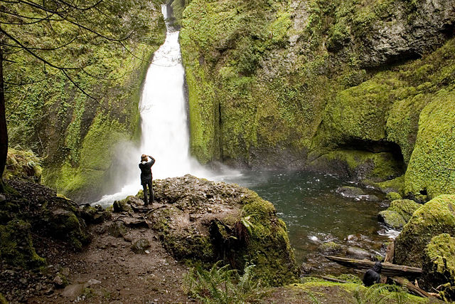
Wahclella Falls is a waterfall along Tanner Creek, a tributary of the Columbia River, Multnomah County…

Twister Falls is a prominent waterfall that is formed as Eagle Creek cascades 140 feet into a narrow canyon…