Natural history
Washington's Channeled Scablands Guide
John Soennichsen · 2012
Explains the Ice Age floods that carved Palouse Falls' canyon and maps drives and hikes along the flood route.
United States · Columbia Plateau, Washington
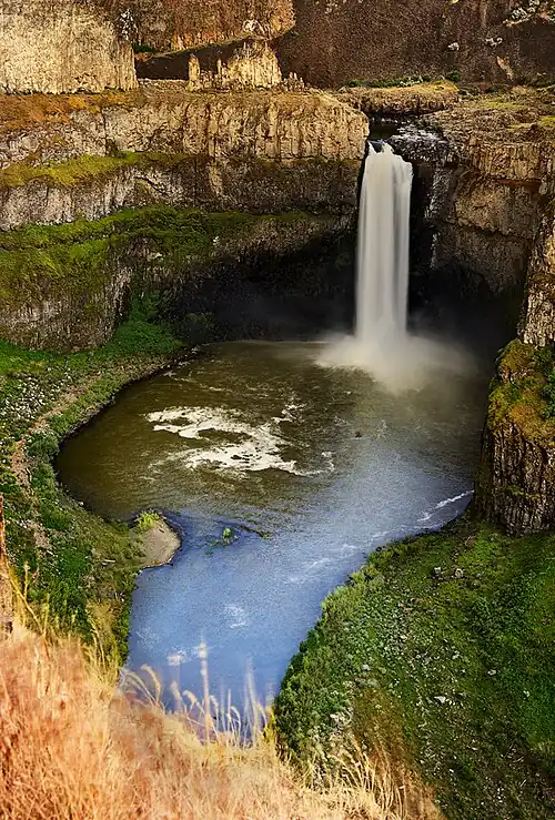
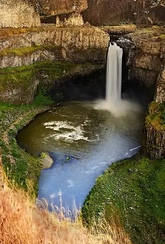
Carved by catastrophic Ice Age floods that repeatedly scoured the Columbia Plateau, the falls drop into a stark basalt canyon that looks abruptly out of place amid the surrounding wheat country. It's Washington's official state waterfall.
Checked September 2026 by David Bussell
Palouse Falls drops 61 metres (200 ft) on the Palouse, inside Palouse Falls State Park. It is a plunge-type fall, and the nearest base for a visit is Washtucna, with PSC the closest airport. Access to the main viewpoint is rated easy.
As a plunge waterfall, water leaves the rock entirely and falls free through the air.
No commercial adventures run at Palouse Falls itself — the experience is the approach and the view. Guided day trips from Washtucna are the easiest way to combine it with the area around it.
Also good forHikingPhotography
Spring runoff gives the fullest, most dramatic flow before summer thins the desert river.
Entry: State park Discover Pass required
This waterfall
Palouse Falls
United States
Height61 mWidth—
Most similar
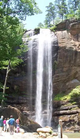
Toccoa Falls
United States
Height57 mWidth—
Also a plunge waterfall, of similar height and in the United States too
Largest curtain
Victoria Falls
Zimbabwe · Zambia
Height108 mWidth1,708 m
Largest single sheet of falling water
Tallest on earth
Angel Falls
Venezuela
Height979 mWidth—
Widest on earth
Khone Phapheng Falls
Laos
Height21 mWidth10,783 m
Measured across the whole multi-channel system
Angel Falls is 16× taller than Palouse Falls. Victoria Falls is 1.8× taller. We don't have a reliable crest width for Palouse Falls yet, so it is left off the width chart. Tallest · widest lists.
4:29
14:46
5:13
Chosen from YouTube; videos belong to their creators and play from YouTube's privacy-enhanced player.
Natural history
John Soennichsen · 2012
Explains the Ice Age floods that carved Palouse Falls' canyon and maps drives and hikes along the flood route.
Walking guide
Roddy Scheer and Adam Sawyer · 2019
Washington waterfall hikes with maps and directions, useful for pairing Snoqualmie or Palouse with lesser-known falls.
Walking guide
Gregory A. Plumb · 2013
Catalogues hundreds of falls in Oregon, Washington and Idaho with access notes, ideal for chaining several falls into one trip.
Guidebook
Marissa Pedersen · 2025
Newest Moon guide to Washington for planning a trip that takes in the Snoqualmie Valley and the eastern Palouse.
46.6647, -118.2278
Palouse Falls is in United States (Columbia Plateau, Washington), inside Palouse Falls State Park. The nearest base is Washtucna and the closest airport is PSC. Its coordinates are 46.6647, -118.2278.
Palouse Falls drops 61 metres (200 feet). It is a plunge-type waterfall on the Palouse.
Peak flow is March to May. Spring runoff gives the fullest, most dramatic flow before summer thins the desert river.
Beyond the viewpoints: hiking and photography. Access to the main viewpoint is rated easy — a short walk or roadside viewpoint.
The usual base is Washtucna, and the closest airport is PSC. A short walk or roadside viewpoint from there. State park Discover Pass required.
Nearby
Dry Falls is a 3.5-mile-long scalloped precipice with four major alcoves, in central Washington scablands.…
Kettle Falls was an ancient and important salmon fishing site on the upper reaches of the Columbia River, in…
Celilo Falls was a tribal fishing area on the Columbia River, just east of the Cascade Mountains, on what is…
Franklin Falls is the first of three major waterfalls on the South Fork Snoqualmie River. The other two…