
United States · Grant County
Dry Falls (Grant County)
Dry Falls is a 3.5-mile-long scalloped precipice with four major alcoves, in central Washington scablands. This cataract complex is on the opposite side of the Upper Grand Coulee from the Columbia River, and at the head of the Lower Grand Coulee, northern end of Lenore Canyon.
Facts from Wikidata and Wikipedia, compiled September 2026; season and access are our estimate, not a visit report. How we build these pages.
Dry Falls (Grant County) drops 121 metres (397 ft). It is a plunge-type fall, and the nearest base for a visit is Grant County, United States. Access to the main viewpoint is rated easy.
Summary adapted from the Wikipedia article (CC BY-SA 4.0).
As a plunge waterfall, water leaves the rock entirely and falls free through the air.
What you can do here
A walk-in-and-look waterfall
No commercial adventures run at Dry Falls (Grant County) itself — the experience is the approach and the view. Guided day trips from Grant County are the easiest way to combine it with the area around it.
Also good forHikingPhotography
When to go
Snowmelt-driven: April to June is the big-water window, and some falls almost disappear by late summer.
Getting there
- Base town Grant County, United States
- Country United States
- Region Grant County, United States, North America
- Access Easy — a short walk or roadside viewpoint
How it compares
 This waterfall
Dry Falls (Grant County)
United States
Height121 mWidth—
 Most similar
Comet Falls
United States
Height116 mWidth9 m
Also a plunge waterfall, of similar height and in the United States too
 Largest curtain
Victoria Falls
Zimbabwe · Zambia
Height108 mWidth1,708 m
Largest single sheet of falling water
 Tallest on earth
Angel Falls
Venezuela
Height979 mWidth—
 Widest on earth
Khone Phapheng Falls
Laos
Height21 mWidth10,783 m
Measured across the whole multi-channel system
Angel Falls is 8.1× taller than Dry Falls (Grant County). It is about the same height as Victoria Falls (108 m). We don't have a reliable crest width for Dry Falls (Grant County) yet, so it is left off the width chart. Tallest · widest lists.
On the map
47.60572, -119.35364
Quick answers
Where is Dry Falls (Grant County)?
Dry Falls (Grant County) is in United States (Grant County). The nearest base is Grant County, United States. Its coordinates are 47.6057, -119.3536.
How tall is Dry Falls (Grant County)?
Dry Falls (Grant County) drops 121 metres (397 feet). It is a plunge-type waterfall.
When is the best time to visit Dry Falls (Grant County)?
Peak flow is April to June. Snowmelt-driven: April to June is the big-water window, and some falls almost disappear by late summer.
What can you do at Dry Falls (Grant County)?
Beyond the viewpoints: hiking and photography. Access to the main viewpoint is rated easy — a short walk or roadside viewpoint.
How do you get to Dry Falls (Grant County)?
The usual base is Grant County, United States. A short walk or roadside viewpoint from there.
Nearby
Closest to Dry Falls (Grant County)
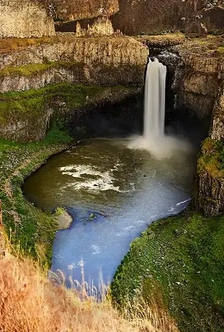
Palouse Falls
Washington State's official state waterfall

Kettle Falls
Kettle Falls was an ancient and important salmon fishing site on the upper reaches of the Columbia River, in…

Franklin Falls
Franklin Falls is the first of three major waterfalls on the South Fork Snoqualmie River. The other two…

Sunset Falls
Sunset Falls is the final of the three waterfalls on the South Fork Skykomish River. The falls drop 104 feet…