Walking the Pennine WayPaddy Dillon
Walking guide
Walking the Pennine Way
Paddy Dillon · 2025
The Pennine Way follows the Tees right past High Force; this guide details that stretch through Teesdale.

United Kingdom · County Durham, England
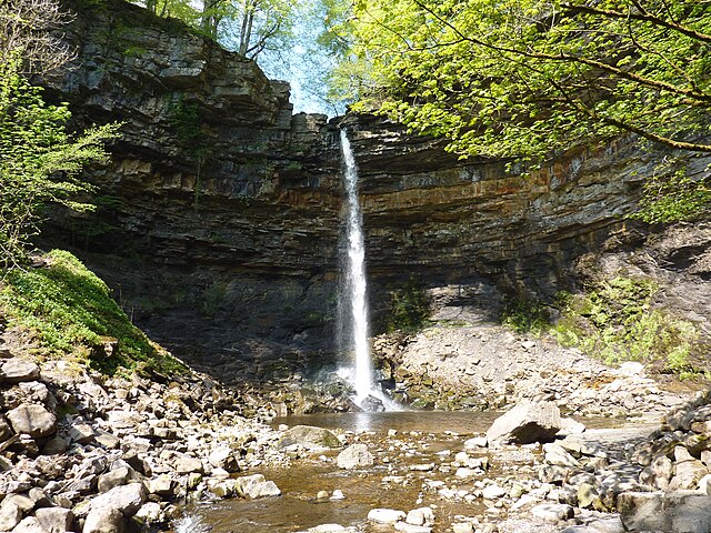
One of England's most powerful waterfalls pours over the edge of the Whin Sill, a slab of hard volcanic rock that also underlies Hadrian Wall further east. The peaty upland water runs amber-brown, a natural tannin stain rather than pollution, most striking after heavy Pennine rain.
Checked September 2026 by David Bussell
High Force drops 21 metres (69 ft) on the Tees, inside North Pennines AONB. It is a plunge-type fall, and the nearest base for a visit is Middleton-in-Teesdale, with NCL the closest airport. Access to the main viewpoint is rated easy.
As a plunge waterfall, water leaves the rock entirely and falls free through the air.
No commercial adventures run at High Force itself — the experience is the approach and the view. Guided day trips from Middleton-in-Teesdale are the easiest way to combine it with the area around it.
Also good forHikingPhotography
Spring and autumn rains give the fullest flow over the resistant dolerite sill.
Entry: Small car park fee
 This waterfall
High Force
United Kingdom
Height21 mWidth—
 Most similar
Jajce Waterfall
Bosnia and Herzegovina
Height22 mWidth—
Also a plunge waterfall, of similar height and in Bosnia and Herzegovina
 Largest curtain
Victoria Falls
Zimbabwe · Zambia
Height108 mWidth1,708 m
Largest single sheet of falling water
 Tallest on earth
Angel Falls
Venezuela
Height979 mWidth—
 Widest on earth
Khone Phapheng Falls
Laos
Height21 mWidth10,783 m
Measured across the whole multi-channel system
Angel Falls is 47× taller than High Force. Victoria Falls is 5.1× taller. We don't have a reliable crest width for High Force yet, so it is left off the width chart. Tallest · widest lists.
 8:47
 4:21
 13:10
Chosen from YouTube; videos belong to their creators and play from YouTube's privacy-enhanced player.
Walking guide
Paddy Dillon · 2025
The Pennine Way follows the Tees right past High Force; this guide details that stretch through Teesdale.

Walking guide
Paddy Dillon · 2012
50 walks in the North Pennines incl. Upper Teesdale circuits taking in High Force, Low Force and Cauldron Snout.
Guidebook
Lonely Planet · 2025
Current Lonely Planet England covering Teesdale and Ullswater, the settings of High Force and Aira Force.
Guidebook
Lonely Planet · 2025
Current Lonely Planet Scotland covering Glen Nevis, Kintail and the Moffat area.
54.6503, -2.1876
High Force is in United Kingdom (County Durham, England), inside North Pennines AONB. The nearest base is Middleton-in-Teesdale and the closest airport is NCL. Its coordinates are 54.6503, -2.1876.
High Force drops 21 metres (69 feet). It is a plunge-type waterfall on the Tees.
Peak flow is March to May and October to November. Spring and autumn rains give the fullest flow over the resistant dolerite sill.
Beyond the viewpoints: hiking and photography. Access to the main viewpoint is rated easy — a short walk or roadside viewpoint.
The usual base is Middleton-in-Teesdale, and the closest airport is NCL. A short walk or roadside viewpoint from there. Small car park fee.
Nearby

Cauldron Snout is a cascade on the upper reaches of the River Tees in Northern England, immediately below the…

Kisdon Force is a series of waterfalls on the River Swale in Swaledale, England. The falls are situated…

Cautley Spout is England's highest waterfall above ground. . The broken cascade of falls tumbles a total of…
Hardraw Force is a waterfall on Hardraw Beck in Hardraw Scar, a wooded ravine just outside the hamlet of…