
Guidebook
Lonely Planet Australia
Lonely Planet · 2024
The 22nd edition covers the Top End, Far North Queensland, Tasmania, Victoria and NSW in one volume.
Australia · Kanangra-Boyd, New South Wales
Carrabeanga Brook falls roughly 110 metres off the edge of the Kanangra plateau into a quartzite gorge in Kanangra-Boyd National Park, part of the Greater Blue Mountains World Heritage Area. There is no lookout or marked walking track to it; the falls are seen by descending the canyon itself, a serious two-day trip of 15 to 20 abseils from the King Pin Fire Trail with an overnight camp by Kanangra Creek.
Checked September 2026 by David Bussell
Carrabeanga Falls drops 110 metres (361 ft) on the Carrabeanga Brook, inside Kanangra-Boyd National Park. It is a tiered-type fall, and the nearest base for a visit is Oberon, with SYD the closest airport. Access to the main viewpoint is rated hard.
As a tiered waterfall, a series of distinct drops, one below the other.
Planning one of these? Check your travel insurance covers adventure activities — SafetyWing is one option.
Canyoners run it from November to March; winter descents are only for parties who already know the canyon.
Entry: No canyoning permit required; check NSW National Parks for current park fees and alerts
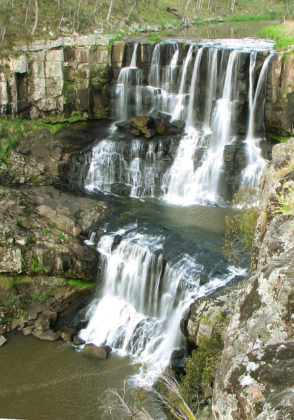 Most similar
Ebor Falls
Australia
Height115 mWidth—
Also a tiered waterfall, of similar height and in Australia too
 Largest curtain
Victoria Falls
Zimbabwe · Zambia
Height108 mWidth1,708 m
Largest single sheet of falling water
 Tallest on earth
Angel Falls
Venezuela
Height979 mWidth—
 Widest on earth
Khone Phapheng Falls
Laos
Height21 mWidth10,783 m
Measured across the whole multi-channel system
Angel Falls is 8.9× taller than Carrabeanga Falls. It is about the same height as Victoria Falls (108 m). We don't have a reliable crest width for Carrabeanga Falls yet, so it is left off the width chart. Tallest · widest lists.
Guidebook
Lonely Planet · 2024
The 22nd edition covers the Top End, Far North Queensland, Tasmania, Victoria and NSW in one volume.
Walking guide
Lonely Planet · 2024
Short and half-day walks around Australia, useful for fitting waterfall hikes into a wider trip.
About this place
Caroline Clements and Dillon Seitchik-Reardon · 2018
A guide to Australian swimming spots including waterfall plunge pools; check the state of each pool locally before swimming.
-33.9346, 150.1333
Carrabeanga Falls is in Australia (Kanangra-Boyd, New South Wales), inside Kanangra-Boyd National Park. The nearest base is Oberon and the closest airport is SYD. Its coordinates are -33.9346, 150.1333.
Carrabeanga Falls drops 110 metres (361 feet). It is a tiered-type waterfall on the Carrabeanga Brook.
Peak flow is January to March and November to December. Canyoners run it from November to March; winter descents are only for parties who already know the canyon.
Beyond the viewpoints: abseiling, canyoning, camping and hiking. Access to the main viewpoint is rated hard — a serious approach: distance, altitude, a boat, or a guide.
Yes. Carrabeanga Falls lies within a UNESCO World Heritage Site — Kanangra-Boyd National Park. Expect park fees, marked trails and rules on where you can walk, swim and fly drones.
The usual base is Oberon, and the closest airport is SYD. A serious approach: distance, altitude, a boat, or a guide from there. No canyoning permit required; check NSW National Parks for current park fees and alerts.
Nearby
 Full guide
A signature day trip from Sydney into the Blue Mountains

Fitzroy Falls is a village in the Wingecarribee Shire, located within the Southern Highlands region of New…

The Carrington Falls is a plunge waterfall across the Kangaroo River located in the Southern Highlands region…

Gibraltar Falls is a waterfall in Australia.