
South America
Waterfalls in Brazil
14 waterfalls, from Iguazú Falls to Toldi Falls — at their best April to May.
Brazil's best-known falls sit on its southern border, where the Iguazu River drops over the edge of the Parana Plateau in a system of some 275 individual cascades, including the Devil's Throat, the single most powerful segment, viewed from catwalks on the Brazilian side. Elsewhere, Brazil's falls are scattered and comparatively little visited by international travellers: Cachoeira da Fumaca, in Bahia's Chapada Diamantina, is one of the country's tallest; Caracol Falls, in Rio Grande do Sul, drops through araucaria pine forest; and Itiquira Falls, in Goiás near Brasília, marks the edge of the central Brazilian plateau. Salto do Yucuma, shared with Argentina, runs for nearly two kilometres along a rock ledge instead of a single drop point, among the world's longest longitudinal waterfalls.
When to go
Iguazu's flow is heaviest in the southern hemisphere summer and following autumn, roughly November-May, after the wet season; the driest, clearest views with less spray tend to fall in the cooler months, August-September. Bahia's Cachoeira da Fumaca and Rio Grande do Sul's Caracol Falls follow a similar pattern, running fullest after summer rains.
Getting around
Iguazu Falls is reached by domestic flight to Foz do Iguacu, with walkways and a park shuttle covering the Brazilian side. Chapada Diamantina and Goiás's Itiquira Falls generally require a hired car or guided tour from the nearest regional city, since public transport does not reach most trailheads.
Entry requirements
Since April 2025, US, Canadian and Australian citizens need a Brazilian e-Visa (US$80.90, arranged online); UK and EU visitors remain visa-free for up to 90 days.
Entry rules checked September 2026. They change without much notice — confirm with the official government source before you travel.
14 destinations
Every waterfall in Brazil
 Full guide
Iguazú Falls
World's largest waterfall system by combined width
UNESCO Devil's Throat
The single most powerful segment of Iguazu Falls

Cachoeira da Fumaça
One of Brazil's tallest waterfalls
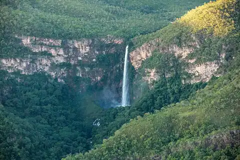
Itiquira Falls
One of central Brazil's tallest waterfalls

Orinduik Falls
The Orinduik Falls lie on the Ireng River on the Pakaraima Mountains. Orinduik Falls is a wide, multi-tiered…

Caracol Falls
Rio Grande do Sul's tallest waterfall

Paulo Afonso Falls
Paulo Afonso Falls is a series of waterfalls on the São Francisco River in the north-east of Brazil adjacent…

Guaíra Falls
The Guairá Falls or Guaíra Falls were a series of immense waterfalls on the Paraná River along the border…
Cristal Falls
Cristal Falls is a waterfall in the Cristal Mountains of Brazil. It is located in the city of Santo Antônio…
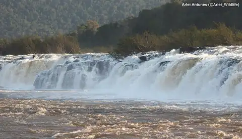
Salto do Yucumã
One of the world's longest longitudinal waterfalls

Chuvisco Falls
Chuvisco Falls is a waterfall on the Rio Preto in Minas Gerais, Brazil, on the boundary between the…

Bahia Falls
Bahia Falls is a waterfall on the Santo Antônio River, in city of Santo Antônio do Rio Abaixo, in the state…

Henriques waterfall
Henriques waterfall is a waterfall located in the Henriques bairro of the municipality of Gonçalves, Minas…

Toldi Falls
Toldi Falls is a waterfall located in the municipality of São Bento do Sapucaí, São Paulo, Brazil.