Lonely Planet BrazilTrent Holden et al.
Guidebook
Lonely Planet Brazil
Trent Holden et al. · 2025
Covers Foz do Iguaçu's panoramic side, Chapada Diamantina for Fumaça, and the Serra Gaúcha around Canela for Caracol.

Brazil · Mato Grosso
Chuvisco Falls is a waterfall on the Rio Preto in Minas Gerais, Brazil, on the boundary between the municipalities of Santo Antônio do Rio Abaixo and São Sebastião do Rio Preto, about 170 kilometres east of Belo Horizonte. The falls have a drop of about 10 metres and are surrounded by dense forest.
Facts from Wikidata and Wikipedia, compiled September 2026; season and access are our estimate, not a visit report. How we build these pages.
Chuvisco Falls drops 10 metres (33 ft). It is a cascade-type fall, and the nearest base for a visit is Santo Antônio do Rio Abaixo, Brazil. Access to the main viewpoint is rated moderate.
Summary adapted from the Wikipedia article (CC BY-SA 4.0).
As a cascade waterfall, water tumbles down a series of rock steps rather than falling free.
No commercial adventures run at Chuvisco Falls itself — the experience is the approach and the view. Guided day trips from Santo Antônio do Rio Abaixo are the easiest way to combine it with the area around it.
Also good forHikingPhotography
Tropical wet season fed: the rains bring the volume, the first dry months bring the clear skies and full falls together.
This waterfall
Chuvisco Falls
Brazil
Height10 mWidth—
 Most similar
Bassin Bleu
Haiti
Height10 mWidth—
Also a cascade waterfall and of similar height
 Largest curtain
Victoria Falls
Zimbabwe · Zambia
Height108 mWidth1,708 m
Largest single sheet of falling water
 Tallest on earth
Angel Falls
Venezuela
Height979 mWidth—
 Widest on earth
Khone Phapheng Falls
Laos
Height21 mWidth10,783 m
Measured across the whole multi-channel system
Angel Falls is 98× taller than Chuvisco Falls. Victoria Falls is 11× taller. We don't have a reliable crest width for Chuvisco Falls yet, so it is left off the width chart. Tallest · widest lists.
Guidebook
Trent Holden et al. · 2025
Covers Foz do Iguaçu's panoramic side, Chapada Diamantina for Fumaça, and the Serra Gaúcha around Canela for Caracol.

Guidebook
Ben Box · 2017
The one-volume continental handbook, useful for multi-country trips that link falls such as Iguazú, Kaieteur and Angel Falls.
-19.2861, -43.2569
Chuvisco Falls is in Brazil (Mato Grosso). The nearest base is Santo Antônio do Rio Abaixo, Brazil. Its coordinates are -19.2861, -43.2569.
Chuvisco Falls drops 10 metres (33 feet). It is a cascade-type waterfall.
Peak flow is January to May. Tropical wet season fed: the rains bring the volume, the first dry months bring the clear skies and full falls together.
Beyond the viewpoints: hiking and photography. Access to the main viewpoint is rated moderate — a real walk — expect stairs, uneven ground or an hour on the trail.
The usual base is Santo Antônio do Rio Abaixo, Brazil. A real walk — expect stairs, uneven ground or an hour on the trail from there.
Nearby

Bahia Falls is a waterfall on the Santo Antônio River, in city of Santo Antônio do Rio Abaixo, in the state…

Toldi Falls is a waterfall located in the municipality of São Bento do Sapucaí, São Paulo, Brazil.

Henriques waterfall is a waterfall located in the Henriques bairro of the municipality of Gonçalves, Minas…
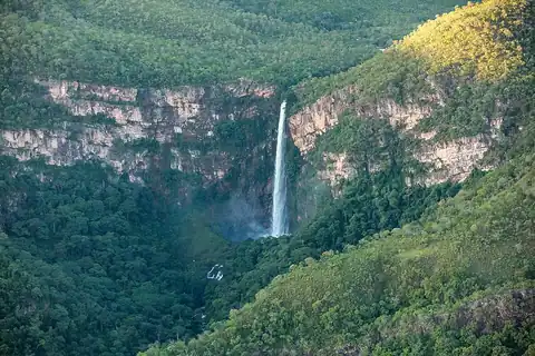
One of central Brazil's tallest waterfalls