
Guidebook
Lonely Planet Canada
Lonely Planet · 2024
Country-wide guide for combining Canadian falls, from Quebec and Ontario to the Rockies and the North.
Canada · Saint John
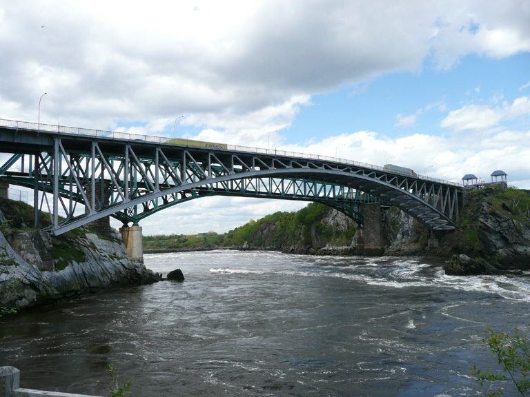
The Reversing Falls are a series of rapids on the Saint John River, located in Saint John, New Brunswick, Canada, where the river runs through a narrow gorge before emptying into the Bay of Fundy. The semi-diurnal tides of the bay force the flow of water to reverse against the prevailing current when the tide is high.
Facts from Wikidata and Wikipedia, compiled September 2026; season and access are our estimate, not a visit report. How we build these pages.
Reversing Falls drops 4 metres (13 ft) on the Saint John River. It is a segmented-type fall, and the nearest base for a visit is City of Saint John, Canada. Access to the main viewpoint is rated moderate.
Summary adapted from the Wikipedia article (CC BY-SA 4.0).
As a segmented waterfall, the flow splits into separate strands as it falls.
Planning one of these? Check your travel insurance covers adventure activities — SafetyWing is one option.
Also good forHikingPhotography
Spring snowmelt and rain make April to June the fullest months; October adds colour, and a hard winter can freeze the face.
 This waterfall
Reversing Falls
Canada
Height4 mWidth—
 Most similar
Hooker Falls
United States
Height4 mWidth—
Of similar height and in the United States
 Largest curtain
Victoria Falls
Zimbabwe · Zambia
Height108 mWidth1,708 m
Largest single sheet of falling water
 Tallest on earth
Angel Falls
Venezuela
Height979 mWidth—
 Widest on earth
Khone Phapheng Falls
Laos
Height21 mWidth10,783 m
Measured across the whole multi-channel system
Angel Falls is 245× taller than Reversing Falls. Victoria Falls is 27× taller. We don't have a reliable crest width for Reversing Falls yet, so it is left off the width chart. Tallest · widest lists.
Guidebook
Lonely Planet · 2024
Country-wide guide for combining Canadian falls, from Quebec and Ontario to the Rockies and the North.
45.26028, -66.09
Reversing Falls is in Canada (Saint John). The nearest base is City of Saint John, Canada. Its coordinates are 45.2603, -66.0900.
Reversing Falls drops 4 metres (13 feet). It is a segmented-type waterfall on the Saint John River.
Peak flow is April to June and October. Spring snowmelt and rain make April to June the fullest months; October adds colour, and a hard winter can freeze the face.
Beyond the viewpoints: kayaking, white-water rafting, hiking and photography. Access to the main viewpoint is rated moderate — a real walk — expect stairs, uneven ground or an hour on the trail.
The usual base is City of Saint John, Canada. A real walk — expect stairs, uneven ground or an hour on the trail from there.
Nearby

Pokiok Falls is a former waterfall in Pokiok, New Brunswick where the Pokiok Stream emptied over a ledge into…

Saint Anne Falls is a waterfall going through Canyon Sainte-Anne, Quebec.
 Full guide
30 metres taller than Niagara Falls

Chaudière Falls is a 35-meter-high waterfall in Lévis, Quebec, along the Chaudière River. It is part of the…