
Walking guide
Exploring Wells Gray Park: The Complete Roads and Trails Guide to Canada's Waterfalls Park
Roland Neave · 2015
The standard guide to Wells Gray, with every road and trail to Helmcken Falls and the park's many other waterfalls.
Canada · British Columbia
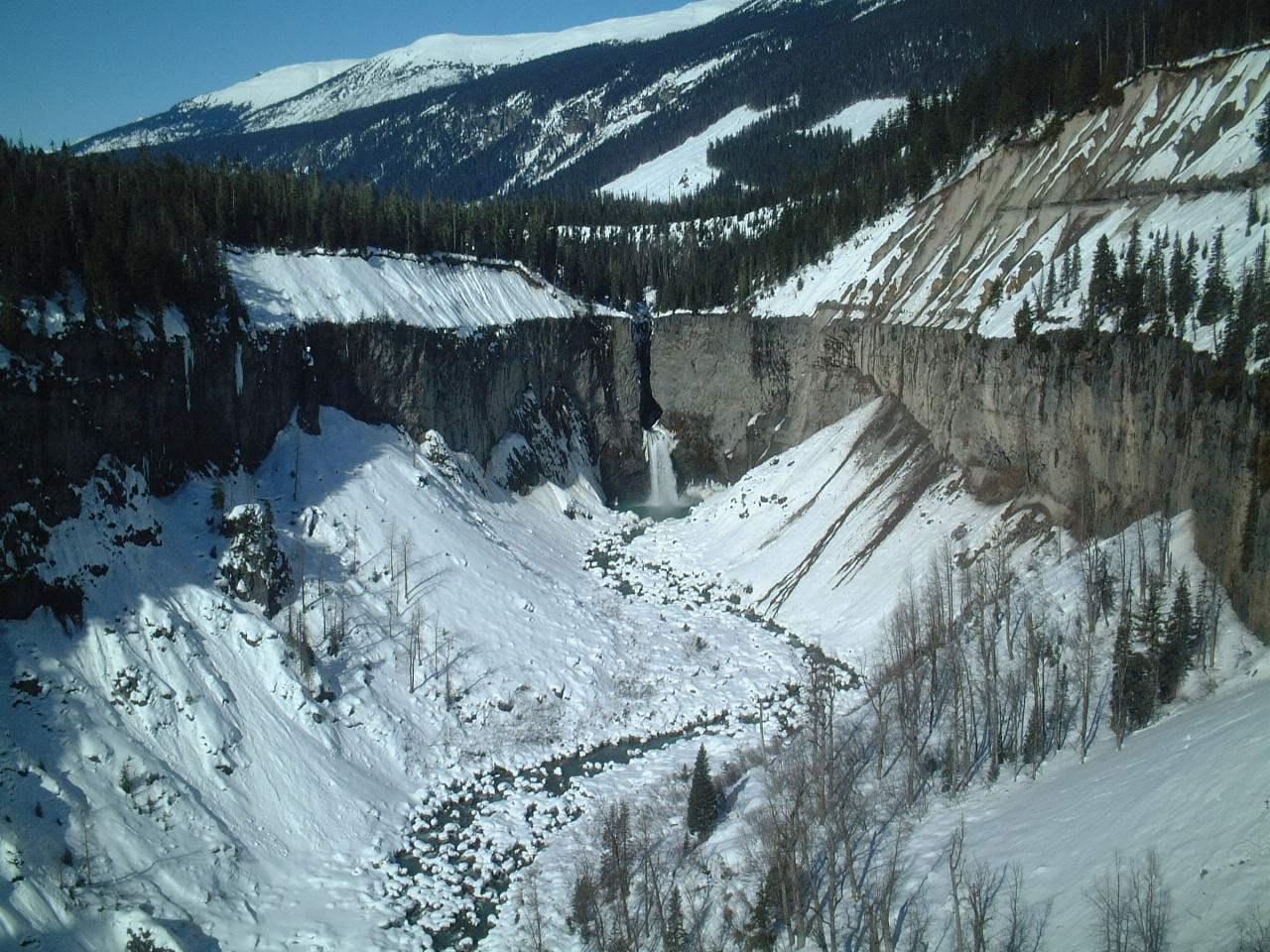
Keyhole Falls is the unofficial name for the largest waterfall along the Lillooet River in British Columbia, Canada. The falls are 115 feet high and are a punchbowl type of waterfall.
Facts from Wikidata and Wikipedia, compiled September 2026; season and access are our estimate, not a visit report. How we build these pages.
Keyhole Falls drops 30 metres (98 ft) on the Lillooet River. It is a cascade-type fall, and the nearest base for a visit is Area C (Pemberton Valley/Mount Currie/D'Arcy), Canada. Access to the main viewpoint is rated moderate.
Summary adapted from the Wikipedia article (CC BY-SA 4.0).
As a cascade waterfall, water tumbles down a series of rock steps rather than falling free.
No commercial adventures run at Keyhole Falls itself — the experience is the approach and the view. Guided day trips from Area C (Pemberton Valley/Mount Currie/D'Arcy) are the easiest way to combine it with the area around it.
Also good forHikingPhotography
Snowmelt-driven: April to June is the big-water window, and some falls almost disappear by late summer.
 This waterfall
Keyhole Falls
Canada
Height30 mWidth—
 Most similar
Issaqueena Falls
United States
Height30 mWidth—
Also a cascade waterfall, of similar height and in the United States
 Largest curtain
Victoria Falls
Zimbabwe · Zambia
Height108 mWidth1,708 m
Largest single sheet of falling water
 Tallest on earth
Angel Falls
Venezuela
Height979 mWidth—
 Widest on earth
Khone Phapheng Falls
Laos
Height21 mWidth10,783 m
Measured across the whole multi-channel system
Angel Falls is 33× taller than Keyhole Falls. Victoria Falls is 3.6× taller. We don't have a reliable crest width for Keyhole Falls yet, so it is left off the width chart. Tallest · widest lists.
Walking guide
Roland Neave · 2015
The standard guide to Wells Gray, with every road and trail to Helmcken Falls and the park's many other waterfalls.

Guidebook
Andrew Hempstead · 2018
Province-wide BC guide covering Wells Gray, Vancouver Island and Yoho for planning a multi-region trip.

Guidebook
Lonely Planet · 2024
Country-wide guide for combining Canadian falls, from Quebec and Ontario to the Rockies and the North.
50.67613, -123.47149
Keyhole Falls is in Canada (British Columbia). The nearest base is Area C (Pemberton Valley/Mount Currie/D'Arcy), Canada. Its coordinates are 50.6761, -123.4715.
Keyhole Falls drops 30 metres (98 feet). It is a cascade-type waterfall on the Lillooet River.
Peak flow is April to June. Snowmelt-driven: April to June is the big-water window, and some falls almost disappear by late summer.
Beyond the viewpoints: hiking and photography. Access to the main viewpoint is rated moderate — a real walk — expect stairs, uneven ground or an hour on the trail.
The usual base is Area C (Pemberton Valley/Mount Currie/D'Arcy), Canada. A real walk — expect stairs, uneven ground or an hour on the trail from there.
Nearby

James Bruce Falls is a waterfall in British Columbia, Canada, the highest-measured waterfall of North America…

Chatterbox Falls is a waterfall in British Columbia, Canada, located at the head or end of Princess Louisa…

Alexander Falls is a waterfall on Madeley Creek, a tributary of Callaghan Creek in the Callaghan Valley area…

Ashlu Falls is a short but significant waterfall along lower Ashlu Creek. The falls are located about 6 km…