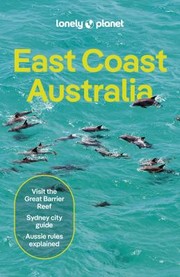
Guidebook
Lonely Planet East Coast Australia
Lonely Planet · 2024
More detail than the national guide on Far North Queensland, the Gold Coast hinterland and the Blue Mountains.

Australia · Queensland
A granite creek with a natural rock slide at the foot of Bartle Frere, Queensland's highest mountain, 75 km south of Cairns. It is the anchor for a Cairns-region waterfall day that takes in Babinda Boulders, Millaa Millaa and Wallaman Falls.
Full guide Checked September 2026 by David Bussell · 35 sources UNESCO World Heritage
Josephine Creek begins as a trickle high on the south-east side of Bartle Frere, at 1,622 metres the highest peak in Queensland, and about 7.5 km later it spills over a jumble of pale granite boulders in the rainforest below. The result is not one big curtain but a stepped cascade in three main drops, the tallest roughly 25 metres, with deep green pools between them. On one broad, water-polished slab the creek has worn a natural slide into the granite, and on a warm dry-season afternoon that slide is the most crowded rock in Far North Queensland.
The layout is simple. From the car park off the Bruce Highway between Babinda and Innisfail, a sealed 1.2 km return track (about 30 minutes, Grade 2) runs through lowland rainforest to a series of viewing decks. A side path drops to the Big Pool, the designated swimming hole and home of the rock slide; the track ends at the top viewing platform, facing the upper falls. Everything above that is a signposted restricted area, and it is restricted for a reason: people have died there.
Most visitors come on a day trip from Cairns and pair Josephine with Babinda Boulders, 15 minutes up the road, or climb the Palmerston Highway to the Atherton Tablelands for the Millaa Millaa waterfall circuit. Hikers use the same car park for the Bartle Frere and Broken Nose trails. Come in the dry season, swim only where the signs allow, and check Queensland Parks' alerts before you drive: the swimming area and viewing platforms are scheduled to close from 2 November 2026 to 28 February 2027.
Queensland Parks' own safety page opens with the words 'People have died here'. Deaths reported at Josephine Falls include a 24-year-old British tourist in 2016, a 23-year-old Korean tourist in 2018 and a man in his 30s in January 2025. The danger is flash flooding, strong currents beneath calm surfaces, slippery rock and submerged objects, and many serious injuries happen in the restricted area at the top of the falls, where access is prohibited and fines apply (A$431 in 2022). Watch the flood-warning lights and never jump or dive. For 2026/27, the viewing platforms and swimming area are scheduled to close from 2 November 2026 to 28 February 2027; check Queensland Parks' alerts before you drive.
Wooroonooran National Park, off the Bruce Highway near Miriwinni
A sealed rainforest track leads to three viewing decks and the Big Pool, a deep green swimming hole below a small side cascade with the natural granite slide at its edge. The top viewing platform looks up at the main drop, which is off-limits to swimmers. The draw is the combination of cold, clear water, the slide, and Bartle Frere's forest rising behind it. It fills up by late morning in the dry season, so arrive early.
About 6 km west of Babinda, roughly 60 km south of Cairns
Babinda Creek runs clear and fast between enormous water-smoothed granite boulders. The upper swimming area is calm and popular; downstream, the Devil's Pool walk leads to a gorge where the creek squeezes through polished rock. The Yidinji name for the area, Bunna Binda, gave the town its name, and the site carries a well-known story of a tragic love affair. About 20 people have drowned here since 1959, most after slipping in below the swimming area.
Theresa Creek Road, Millaa Millaa, Atherton Tablelands
A short sealed loop off the Palmerston Highway links three very different falls. Millaa Millaa Falls is an 18-metre single drop over striated basalt into a round swimming pool, the one from the shampoo advertisements. Zillie Falls is seen from a platform at the top. Ellinjaa Falls, about 12 metres, is a few minutes down a sealed path to a shallow pool where platypus live. The Tablelands sit cooler and higher than the coast.
Girringun National Park, 51 km south-west of Ingham
The long drive. Stony Creek falls 268 metres in a single sheer drop, 305 metres in total, into a gorge on the edge of the Wet Tropics, which makes it the highest permanent single-drop waterfall in Australia. It is a lookout and a gorge walk rather than a swim, and it is a full day from Cairns, so most people break the journey in Ingham or camp at the national park camping area near the top.
If you have one day, do Josephine Falls and Babinda Boulders together: both are within an hour or so of Cairns and both are proper swims. With two days, add the Millaa Millaa circuit and sleep on the Tablelands. Save Wallaman Falls for a road trip south towards Townsville, and between November 2026 and February 2027 treat Josephine as closed for swimming.
May to October gives the safest swimming and clearest water; November to April brings full falls, frequent closures and, for 2026/27, a scheduled shutdown of Josephine's swimming area.
The wet season, roughly November to April, decides everything. Rain on Bartle Frere can send a wall of water down Josephine Creek under a blue sky, and Queensland Parks warns that flash flooding can happen there at any time of year.
Clearer water, lower and steadier flow, cooler nights on the Tablelands and the best conditions for the rock slide and the Bartle Frere trail. It is also Cairns' high season, so the Big Pool and Millaa Millaa Falls get busy from late morning with day tours. The creek still runs strongly, especially at the top tier, and the flood-warning lights still apply. June to August water is cold.
Heavy tropical downpours, humidity and full, loud waterfalls. The Tablelands falls look their most powerful, but swimming becomes a gamble: water can rise and turn brown within minutes, and Queensland Parks closes swimming areas when it does. For the 2026/27 wet, Josephine's viewing platforms and swimming area are scheduled to close entirely from 2 November to 28 February. Cyclones and flooded roads can cut access.
Bartle Frere and its neighbour Bellenden Ker (1,593 m), Queensland's two highest peaks, are the reason Josephine Creek can flood without warning. Bellenden Ker's summit station averages about 8,000 mm of rain a year, the highest of any weather station in Australia, and recorded 12,461 mm in 2000. From the Bruce Highway near Babinda you can see its summit cableway, built to service the transmitter towers, when the cloud lifts.
Tour prices are 2026 advertised adult rates in Australian dollars from operator and reseller websites, converted at about 0.70 US dollars to the Australian dollar (late September 2026); park access is free, and hotel tiers reflect each property's positioning rather than a checked nightly rate, so treat all figures as a planning guide rather than a quote.
Walk the sealed 1.2 km return track through lowland rainforest, take the side path to the Big Pool, and sit on the smooth granite slab at the edge of the side cascade to slide into water at least 1.5 metres deep. Then continue to the top viewing platform for the upper falls. Never jump or dive, stay out of the restricted area above the platform, and get out immediately if the water rises or changes colour.
Best May – October; swimming area closed 2 Nov 2026 – 28 Feb 2027
No booking needed.
A small-group day from Cairns with a deliberately loose itinerary: the listed stops include Josephine Falls, Millaa Millaa Falls, Lake Eacham crater lake, the Cathedral Fig Tree and Tablelands lookouts, with a picnic lunch, snacks and several swims. Recent guests mention the rock slide at Josephine and swims at Babinda Boulders too. Pick-up is at Bus Bay 7 of the Reef Fleet Terminal in Cairns. During the Josephine closure expect substitutes.
Year-round; itinerary shifts with weather and water levels
The classic combination in one bus: a morning swim and the rock slide at Josephine Falls, the Devil's Pool story at Babinda Boulders, then up to the Tablelands for Millaa Millaa Falls and the Cathedral Fig Tree, with lunch and morning and afternoon tea included. Pick-ups cover Cairns, the Northern Beaches, Palm Cove and Port Douglas, which makes it one of the few options for people staying north of the city.
Year-round, subject to water conditions
The short version for people who want a lie-in: a 10am coach pick-up in Cairns, 90 minutes at Josephine Falls for the rock slide, then a picnic lunch, a guided rainforest walk with Indigenous stories and a swim at Babinda Boulders, and back via Gordonvale by mid-afternoon. It is sold through Visit Cairns and Hot Getaways; neither listing names the operating company, so ask when you book.
Mondays, Wednesdays and Fridays
Theresa Creek Road loops off the Palmerston Highway past three falls in about 15–17 km. Swim beneath the 18-metre Millaa Millaa Falls, where there are toilets and change rooms; look down Zillie Falls from its platform; then walk about 200 metres down a sealed path to Ellinjaa Falls, where platypus live in the creek. Skip the unofficial eroded path to the base of Zillie. Allow roughly 1 hour 40 minutes' drive from Cairns.
Year-round; swimming best May – October
No booking needed.
Fifteen minutes north of the Josephine turn-off, Babinda Creek runs between huge granite boulders polished smooth over millennia. Swim in the signed upper area, then take the 1.2 km return Devil's Pool walk to the gorge, where the Yidinji story of a young woman and her lover explains the pull of the water. It is not a legend to test: about 20 people have drowned here since 1959, mostly downstream of the swimming area.
Year-round; swim only when the water is calm and clear
No booking needed.
Queensland's highest summit, Chooreechillum to the Noongyanbudda Ngadjon people, starts from the Josephine Falls car park and climbs about 1,500 metres through lowland rainforest into moss-draped cloud forest, where Australia's only native rhododendron grows on the granite boulders. The trail is steep, involves rock scrambling, and is often in cloud; hikers have been lost for days. Start at first light, carry a map and beacon, expect leeches, and read Queensland Parks' Bartle Frere trail notes before you go.
Dry season, roughly April – October
No booking needed.
A Grade 5 trail, the hardest category in Queensland's system, from the same car park to Broken Nose, a spur on the southern side of Bartle Frere. It is shorter than the summit but still a long, steep, unserviced day with no toilets or picnic tables along the way. Treat it as a serious bushwalk: go with company, carry water and a beacon, and turn back if cloud or rain comes in.
Dry season
No booking needed.
The long drive south: Wallaman Falls drops 268 metres in a single leap, 305 metres in total, into a gorge 51 km south-west of Ingham. Look from the lookout, then walk the Djinda track down into the gorge. Queensland Parks closed the camping areas and walking tracks from 8 April to 16 October 2026 for works, so check the park page before committing to the drive. Watch for cassowaries on the road.
Best late wet to early dry (February – May) for volume; check alerts
No booking needed.
The creeks of the Tablelands waterfall circuit are platypus habitat, and Ellinjaa Falls is one of the easier places to try. Arrive at first or last light, stand still on the bank well away from the pool's edge, and watch for a dark shape and a line of bubbles on flat water. Ulysses butterflies are often seen around Millaa Millaa Falls on sunny days.
Year-round
No booking needed.
There is no accommodation at Josephine Falls itself; most people base themselves in Cairns and drive or tour down, while the Atherton Tablelands offer rainforest treehouses within reach of the Millaa Millaa circuit.
A five-star resort on the Cairns Esplanade with a lagoon pool, rooftop bar and restaurants, and free morning yoga twice a week. Tour pick-ups and the Reef Fleet Terminal are a short walk, which suits an early departure south.
A waterfront hotel between Marlin Marina and Trinity Inlet, with a pool in tropical gardens and views to the ranges. It is a few steps from the Reef Fleet Terminal, where Barefoot Tours collects its guests.
Cairns' big backpacker resort: ensuite dorms from four to ten beds, private rooms away from the nightclub, a resort pool and a lively bar scene. Good for meeting people to share a hire car to the falls; not for light sleepers.
Treehouses with fireplaces, baths and private balconies on 230 acres of forest adjoining the national park, about 90 minutes from Cairns. A Nature Refuge since 2007, with 10 km of private tracks, more than 160 bird species and resident cassowaries.
Five two-bedroom treehouses, a larger three-bedroom house and a couples' cabin in 100 acres of rainforest, each self-contained with a barbecue on the deck. The owners report cassowaries, platypus and tree kangaroos on the property, and the waterfall circuit is close by.
Six timber pole treehouses with double spas and wood fires on the slopes of an extinct volcano, couples only and strictly no children. Breakfast provisions are stocked in the fridge, and tree kangaroos are regularly seen from the decks.
A modern hostel a step from the Innisfail river esplanade, about 25 minutes south of Josephine, with a communal kitchen, lockers and card access, plus a well-reviewed wood-fired pizza restaurant out front. A practical base for an early swim before the tour buses.
A caravan and tourist park in the small dairy town at the start of the waterfall circuit, listed by the Atherton Tablelands tourism body. The simplest way to be at Millaa Millaa Falls before the day tours arrive.
Search all Cairns accommodation
About 75 km north of Josephine Falls by the Bruce Highway, roughly an hour to an hour and a quarter by car. Domestic flights from Australia's main cities and a smaller set of international routes; car hire at the terminal.
The closer airport for Wallaman Falls, which lies 51 km south-west of Ingham. Useful for a one-way drive north from Townsville to Cairns taking in Wallaman, Josephine and the Tablelands.
Most international travellers connect through Sydney, Brisbane or Melbourne to Cairns.
There is no public transport to Josephine Falls: drive or take a tour. Head south from Cairns on the Bruce Highway past Babinda, turn west on the signposted road towards Bartle Frere, and follow the signs through cane and banana farms to the car park at the end of a sealed road. The car park fills by late morning in the dry season. For the Tablelands, continue south to Innisfail and climb the Palmerston Highway to Millaa Millaa; the circuit is about 1 hour 40 minutes from Cairns by the direct route. Before you set out, check Queensland Parks' park alerts page for Josephine Falls: closures can be announced at short notice.
Check eligibility on the Department of Home Affairs website (immi.homeaffairs.gov.au) before you travel, and avoid third-party sites that charge extra for the ETA or eVisitor.
 This waterfall
Josephine Falls
Australia
Height25 mWidth—
 Most similar
Whangārei Falls
New Zealand
Height26 mWidth—
Also a cascade waterfall, of similar height and in New Zealand
 Largest curtain
Victoria Falls
Zimbabwe · Zambia
Height108 mWidth1,708 m
Largest single sheet of falling water
 Tallest on earth
Angel Falls
Venezuela
Height979 mWidth—
 Widest on earth
Khone Phapheng Falls
Laos
Height21 mWidth10,783 m
Measured across the whole multi-channel system
Angel Falls is 39× taller than Josephine Falls. Victoria Falls is 4.3× taller. We don't have a reliable crest width for Josephine Falls yet, so it is left off the width chart. Tallest · widest lists.
 3:59
 3:36
 2:35
Chosen from YouTube; videos belong to their creators and play from YouTube's privacy-enhanced player.
Guidebook
Lonely Planet · 2024
More detail than the national guide on Far North Queensland, the Gold Coast hinterland and the Blue Mountains.

Guidebook
Lonely Planet · 2024
The 22nd edition covers the Top End, Far North Queensland, Tasmania, Victoria and NSW in one volume.
Walking guide
Lonely Planet · 2024
Short and half-day walks around Australia, useful for fitting waterfall hikes into a wider trip.
About this place
Caroline Clements and Dillon Seitchik-Reardon · 2018
A guide to Australian swimming spots including waterfall plunge pools; check the state of each pool locally before swimming.
Yes, in the Big Pool, the designated swimming area with the natural rock slide, when conditions allow. The top section of the falls is a prohibited restricted area. Queensland Parks has scheduled the swimming area and viewing platforms to close from 2 November 2026 to 28 February 2027, and it closes swimming at short notice after rain, so check park alerts first.
It can be. People have died there, including tourists in 2016 and 2018 and a man in January 2025. The risks are flash flooding from rain on Bartle Frere, strong currents under calm surfaces, slippery rock and submerged objects. Swim only in the signed area, never jump or dive, stay out of the restricted top section, and leave the water if it rises or discolours.
There is no crocodile warning on Queensland Parks' Josephine Falls safety page, and the falls sit on a fast freshwater rainforest creek. Estuarine crocodiles live in Far North Queensland's coastal rivers and estuaries, so the rule is simple: swim only at signed freshwater spots such as Josephine, Babinda Boulders and the Tablelands falls, not in lowland rivers.
About 75 km south, off the Bruce Highway between Babinda and Innisfail, roughly an hour to an hour and a quarter by car. There is no public transport. Half-day tours leave Cairns at 10am on Mondays, Wednesdays and Fridays, and full-day tours combine Josephine with Babinda Boulders and the Millaa Millaa waterfall circuit.
The Josephine Falls walking track is 1.2 km return, about 30 minutes of walking, rated Grade 2. It is sealed and runs through lowland rainforest to a series of viewing decks, with a side path to the Big Pool swimming area. Allow two to three hours if you plan to swim and ride the rock slide.
May to October, the dry season, when the water is clearer and flash floods less frequent, though they can happen in any month. The wet season, roughly November to April, brings heavy rain and frequent swimming closures; for 2026/27 the swimming area and viewing platforms are scheduled to be closed from 2 November to 28 February.
Yes, by car. Swim at Josephine early, drive south to Innisfail and up the Palmerston Highway to Millaa Millaa, then loop Theresa Creek Road for Millaa Millaa, Zillie and Ellinjaa falls before returning to Cairns over the Tablelands. It is a long day; an overnight on the Tablelands makes it easier. Several Cairns day tours cover both.
Almost everyone except New Zealanders needs authority before flying. US and Canadian passport holders use the Australian ETA, applied for in the official app for a AUD 20 service charge. UK and EU passport holders use the free eVisitor. Both allow stays of up to 3 months at a time. Apply only through the Department of Home Affairs.
Josephine Falls is in Australia (North Queensland), inside Wooroonooran National Park. The nearest base is Miriwinni and the closest airport is CNS. Its coordinates are -17.4319, 145.8593.
Prices, fees and entry rules change. We re-check full guides regularly; spotted something out of date? Tell us.
Nearby

Often called Australia's most photographed waterfall

The Malanda Falls is a cascade waterfall on the North Johnstone River, located in the Tablelands Region in…

The Dinner Falls is a mix of three waterfalls that display plunge, segmented and cascade characteristics on…

The Millstream Falls , a tiered plunge waterfall on The Millstream, is located in the UNESCO World…