
Guidebook
Lonely Planet Japan
Lonely Planet · 2024
The 18th edition covers Nikko, the Kii Peninsula and Ibaraki, so one book handles Kegon, Nachi and Fukuroda.

Japan · Yurihonjo
Hottai Falls is a waterfall in the city of Yurihonjō, Akita Prefecture, Japan, on the Akasawa River, a tributary of the Koyoshi River system in the foothills of Mount Chōkai. It is one of "Japan’s Top 100 Waterfalls", in a listing published by the Japanese Ministry of the Environment in 1990.
Facts from Wikidata and Wikipedia, compiled September 2026; season and access are our estimate, not a visit report. How we build these pages.
Hottai Falls drops over a series of steps on the Akasawa River. It is a plunge-type fall, and the nearest base for a visit is Yurihonjō, Japan. Access to the main viewpoint is rated moderate.
Summary adapted from the Wikipedia article (CC BY-SA 4.0).
As a plunge waterfall, water leaves the rock entirely and falls free through the air.
Also good forHikingPhotography
 This waterfall
Hottai Falls
Japan
Height—Width—
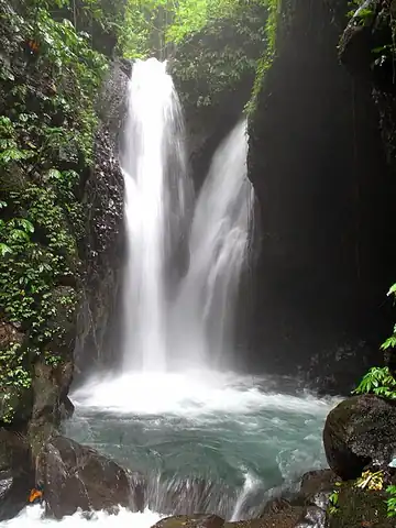 Most similar
Gitgit Falls
Indonesia
Height35 mWidth—
Also a plunge waterfall, with swimming and in Indonesia
 Largest curtain
Victoria Falls
Zimbabwe · Zambia
Height108 mWidth1,708 m
Largest single sheet of falling water
 Tallest on earth
Angel Falls
Venezuela
Height979 mWidth—
 Widest on earth
Khone Phapheng Falls
Laos
Height21 mWidth10,783 m
Measured across the whole multi-channel system
We don't have a reliable crest width for Hottai Falls yet, so it is left off the width chart. Tallest · widest lists.
Guidebook
Lonely Planet · 2024
The 18th edition covers Nikko, the Kii Peninsula and Ibaraki, so one book handles Kegon, Nachi and Fukuroda.
Guidebook
Rough Guides · 2024
A current alternative to Lonely Planet, with practical detail on rail passes and getting to Nikko and the Kii Peninsula.
Guidebook
DK Eyewitness · 2024
Illustrated coverage of Nikko's shrines and the Kumano sites, handy for understanding what surrounds Kegon and Nachi.
39.10508, 140.16269
Hottai Falls is in Japan (Yurihonjo). The nearest base is Yurihonjō, Japan. Its coordinates are 39.1051, 140.1627.
Peak flow is May to July and October to November. Snowmelt and the June rains fill the falls; October and November add autumn colour.
Beyond the viewpoints: swimming, hiking and photography. Access to the main viewpoint is rated moderate — a real walk — expect stairs, uneven ground or an hour on the trail.
Yes — swimming is a normal part of a visit to Hottai Falls, in the pools away from the falling water. Only swim where it is permitted on the day, stay clear of the base of the falls where currents recirculate, and skip it after heavy rain.
The usual base is Yurihonjō, Japan. A real walk — expect stairs, uneven ground or an hour on the trail from there.
Nearby

Naso no Shirataki is a waterfall located in Nikaho, Akita Prefecture, Japan. It became a nationally…

Shiraito Falls is a waterfall in the Furukuchi district of Tozawa, Yamagata Prefecture, Japan, on a branch of…

Nanatsu Falls is a waterfall located in the city of Tsuruoka, Yamagata Prefecture, Japan, on a branch of the…

Akiu Great Falls is a waterfall located in Taihaku-ku, Sendai, Miyagi Prefecture, Japan. It is a nationally…