Walking guide
Hiking Trails 3: Northern Vancouver Island
Richard K. Blier (ed.), Vancouver Island Hiking Trails Society · 2012
Local trail society guide covering Strathcona Park routes, including the long approach to Della Falls.
Canada · Vancouver Island, British Columbia
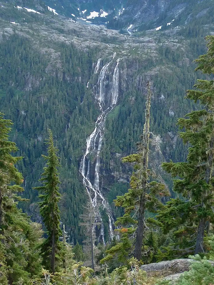
One of Canada's tallest waterfalls tumbles down a remote Vancouver Island valley reachable only by boating the length of Great Central Lake followed by a strenuous day-long hike. Its remoteness keeps visitor numbers far lower than falls of comparable height elsewhere in North America.
Checked September 2026 by David Bussell
Della Falls drops 440 metres (1,444 ft) on the Drinkwater Creek, inside Strathcona Provincial Park. It is a tiered-type fall, and the nearest base for a visit is Port Alberni, with YPB the closest airport. Access to the main viewpoint is rated hard.
Della Falls is number 4 on our list of waterfalls between 100 and 500 metres. As a tiered waterfall, a series of distinct drops, one below the other.
No commercial adventures run at Della Falls itself — the experience is the approach and the view. Guided day trips from Port Alberni are the easiest way to combine it with the area around it.
Also good forCampingHikingPhotography
Summer snowmelt keeps the multi-tiered drop fullest; access requires a boat crossing plus a full-day hike.
Entry: Free; boat shuttle on Great Central Lake extra
This waterfall
Della Falls
Canada
Height440 mWidth—
Largest curtain
Victoria Falls
Zimbabwe · Zambia
Height108 mWidth1,708 m
Largest single sheet of falling water
Tallest on earth
Angel Falls
Venezuela
Height979 mWidth—
Widest on earth
Khone Phapheng Falls
Laos
Height21 mWidth10,783 m
Measured across the whole multi-channel system
Angel Falls is 2.2× taller than Della Falls. It drops 4.1× further than Victoria Falls (108 m). We don't have a reliable crest width for Della Falls yet, so it is left off the width chart. Tallest · widest lists.
19:43
5:00
10:04
Chosen from YouTube; videos belong to their creators and play from YouTube's privacy-enhanced player.
Walking guide
Richard K. Blier (ed.), Vancouver Island Hiking Trails Society · 2012
Local trail society guide covering Strathcona Park routes, including the long approach to Della Falls.

Guidebook
Andrew Hempstead · 2018
Province-wide BC guide covering Wells Gray, Vancouver Island and Yoho for planning a multi-region trip.

Guidebook
Lonely Planet · 2024
Country-wide guide for combining Canadian falls, from Quebec and Ontario to the Rockies and the North.
49.4552, -125.5361
Della Falls is in Canada (Vancouver Island, British Columbia), inside Strathcona Provincial Park. The nearest base is Port Alberni and the closest airport is YPB. Its coordinates are 49.4552, -125.5361.
Della Falls drops 440 metres (1,444 feet). It is a tiered-type waterfall on the Drinkwater Creek.
Peak flow is June to August. Summer snowmelt keeps the multi-tiered drop fullest; access requires a boat crossing plus a full-day hike.
Beyond the viewpoints: camping, hiking and photography. Access to the main viewpoint is rated hard — a serious approach: distance, altitude, a boat, or a guide.
The usual base is Port Alberni, and the closest airport is YPB. A serious approach: distance, altitude, a boat, or a guide from there. Free; boat shuttle on Great Central Lake extra.
Nearby
Englishman River Falls Provincial Park is a provincial park in British Columbia, Canada. It is located west…
Chatterbox Falls is a waterfall in British Columbia, Canada, located at the head or end of Princess Louisa…
James Bruce Falls is a waterfall in British Columbia, Canada, the highest-measured waterfall of North America…
Ashlu Falls is a short but significant waterfall along lower Ashlu Creek. The falls are located about 6 km…