
Guidebook
Lonely Planet Canada
Lonely Planet · 2024
Country-wide guide for combining Canadian falls, from Quebec and Ontario to the Rockies and the North.
Canada · Ontario
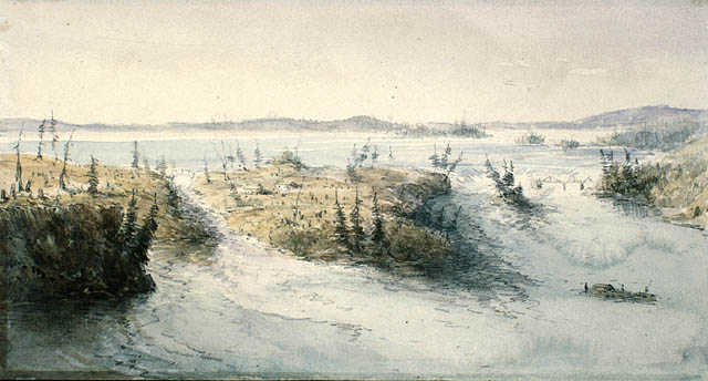
The Chaudière Falls , also known as the Kana:tso or Akikodjiwan Falls, are a set of cascades and waterfall in the centre of the Ottawa-Gatineau metropolitan area in Canada where the Ottawa River narrows between a rocky escarpment on both sides of the river.
Facts from Wikidata and Wikipedia, compiled September 2026; season and access are our estimate, not a visit report. How we build these pages.
Chaudière Falls (Ontario) drops 10 metres (33 ft). It is a cascade-type fall, and the nearest base for a visit is Gatineau, Canada. Access to the main viewpoint is rated hard.
Summary adapted from the Wikipedia article (CC BY-SA 4.0).
Chaudière Falls (Ontario) is number 3 on our list of waterfalls within an hour of a capital city. As a cascade waterfall, water tumbles down a series of rock steps rather than falling free.
No commercial adventures run at Chaudière Falls (Ontario) itself — the experience is the approach and the view. Guided day trips from Gatineau are the easiest way to combine it with the area around it.
Also good forHikingPhotography
Spring snowmelt and rain make April to June the fullest months; October adds colour, and a hard winter can freeze the face.
This waterfall
Chaudière Falls (Ontario)
Canada
Height10 mWidth—
 Most similar
Bassin Bleu
Haiti
Height10 mWidth—
Also a cascade waterfall, of similar height and in Haiti
 Largest curtain
Victoria Falls
Zimbabwe · Zambia
Height108 mWidth1,708 m
Largest single sheet of falling water
 Tallest on earth
Angel Falls
Venezuela
Height979 mWidth—
 Widest on earth
Khone Phapheng Falls
Laos
Height21 mWidth10,783 m
Measured across the whole multi-channel system
Angel Falls is 98× taller than Chaudière Falls (Ontario). Victoria Falls is 11× taller. We don't have a reliable crest width for Chaudière Falls (Ontario) yet, so it is left off the width chart. Tallest · widest lists.
Guidebook
Lonely Planet · 2024
Country-wide guide for combining Canadian falls, from Quebec and Ontario to the Rockies and the North.
45.4206, -75.7222
Chaudière Falls (Ontario) is in Canada (Ontario). The nearest base is Gatineau, Canada. Its coordinates are 45.4206, -75.7222.
Chaudière Falls (Ontario) drops 10 metres (33 feet). It is a cascade-type waterfall.
Peak flow is April to June and October. Spring snowmelt and rain make April to June the fullest months; October adds colour, and a hard winter can freeze the face.
Beyond the viewpoints: hiking and photography. Access to the main viewpoint is rated hard — a serious approach: distance, altitude, a boat, or a guide.
The usual base is Gatineau, Canada. A serious approach: distance, altitude, a boat, or a guide from there.
Nearby

The Rideau Falls are two waterfalls located in Ottawa, Ontario, Canada, where the Rideau River empties into…

The Hog's Back Falls, officially known as the Prince of Wales Falls, but rarely referred to by this name, are…

The Coulonge Chutes is a non-profit recreation park and historical exhibition area operating in…

The Rapides du Cheval Blanc, or White Horse Rapids, flow between the Island of Montreal, Pierrefonds-Roxboro…