Lonely Planet PeruBrendan Sainsbury et al.
Guidebook
Lonely Planet Peru
Brendan Sainsbury et al. · 2025
Covers the Amazonas region around Chachapoyas, the base for the Gocta and Yumbilla hikes and Kuélap fortress.
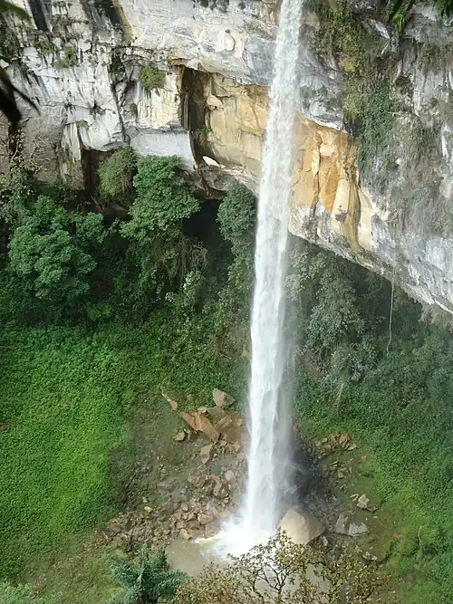
Peru · Amazonas
Catarata Yumbilla
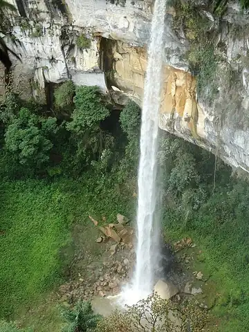
Measured in 2007 and found to be taller than nearby Gocta, this multi-tiered cascade near Cuispes ranks among the highest waterfalls anywhere and is reached on a trail of about an hour and a half along the foot of the cliffs. Flow is thin in dry months, so the tallest drops sometimes fan into mist rather than a solid curtain.
Checked September 2026 by David Bussell
Yumbilla Falls drops 896 metres (2,940 ft) on the Yumbilla. It is a tiered-type fall, and the nearest base for a visit is Cuispes, with CHH the closest airport. Access to the main viewpoint is rated moderate.
Yumbilla Falls is the second-tallest of the 5 we cover in Peru; number 5 on our list of the tallest waterfalls in the world. As a tiered waterfall, a series of distinct drops, one below the other.
No commercial adventures run at Yumbilla Falls itself — the experience is the approach and the view. Guided day trips from Cuispes are the easiest way to combine it with the area around it.
Also good forHikingPhotography
Dry season keeps the steep forest approach passable; flow is thin outside rainy months.
Entry: Local community fee ~$10 USD
 This waterfall
Yumbilla Falls
Peru
Height896 mWidth—
 Most similar
Gocta Falls
Peru
Height771 mWidth—
Also a tiered waterfall, of similar height and in Peru too
 Largest curtain
Victoria Falls
Zimbabwe · Zambia
Height108 mWidth1,708 m
Largest single sheet of falling water
 Tallest on earth
Angel Falls
Venezuela
Height979 mWidth—
 Widest on earth
Khone Phapheng Falls
Laos
Height21 mWidth10,783 m
Measured across the whole multi-channel system
Angel Falls is 83 m taller than Yumbilla Falls. It drops 8.3× further than Victoria Falls (108 m). We don't have a reliable crest width for Yumbilla Falls yet, so it is left off the width chart. Tallest · widest lists.
 11:57
 29:58
 6:08
Chosen from YouTube; videos belong to their creators and play from YouTube's privacy-enhanced player.
Guidebook
Brendan Sainsbury et al. · 2025
Covers the Amazonas region around Chachapoyas, the base for the Gocta and Yumbilla hikes and Kuélap fortress.

Guidebook
Ben Box · 2017
The one-volume continental handbook, useful for multi-country trips that link falls such as Iguazú, Kaieteur and Angel Falls.
-5.9189, -77.9018
Yumbilla Falls is in Peru (Amazonas). The nearest base is Cuispes and the closest airport is CHH. Its coordinates are -5.9189, -77.9018.
Yumbilla Falls drops 896 metres (2,940 feet). It is a tiered-type waterfall on the Yumbilla.
Peak flow is May to August. Dry season keeps the steep forest approach passable; flow is thin outside rainy months.
Beyond the viewpoints: hiking and photography. Access to the main viewpoint is rated moderate — a real walk — expect stairs, uneven ground or an hour on the trail.
The usual base is Cuispes, and the closest airport is CHH. A real walk — expect stairs, uneven ground or an hour on the trail from there. Local community fee ~$10 USD.
Nearby
Full guide One of the world's tallest waterfalls, unknown to the wider world until 2006

María Jiray is a man-made waterfall located at 3400 meters above sea level, near the town of Acopalca, in the…

The Agoyán waterfall is a waterfall on the Pastaza River outside of the tourist town of Baños de Agua Santa…

Pailón del Diablo is one of the most famous waterfalls in Ecuador, located near the town of Río Verde in the…