Lonely Planet PeruBrendan Sainsbury et al.
Guidebook
Lonely Planet Peru
Brendan Sainsbury et al. · 2025
Covers the Amazonas region around Chachapoyas, the base for the Gocta and Yumbilla hikes and Kuélap fortress.

Peru · Amazonas
Gocta drops 771 metres in two tiers out of the cloud forest above the Utcubamba valley, with Yumbilla, taller still, a short drive away and the Chachapoya fortress of Kuélap across the valley. Chachapoyas, northern Peru's quiet highland capital, is the base for all three.
Full guide Checked September 2026 by David Bussell · 26 sources
Gocta is two waterfalls stacked on one cliff. The Cocahuayco stream runs off the forested rim of the Bongará hills and falls about 231 metres into a hanging basin, then goes over again for roughly 540 metres, a single ribbon so long that the wind shreds it into spray well before the bottom. The total, 771 metres, puts it among the tallest waterfalls on Earth, yet villagers in Cocachimba and San Pablo were the only people who knew it well until a German-led survey in 2002 and a Peruvian government announcement in 2006 put it on the map.
You experience Gocta on foot, and the side you start from decides what you see. From Cocachimba, a village on a shelf above the valley, a 5.5-kilometre trail drops and climbs through cloud forest to the plunge pool at the base of the lower tier, with the full height in view much of the way. From San Pablo, higher up the opposite flank, a longer trail runs to the foot of the upper tier. Fit walkers link the two in a single day, starting in San Pablo and finishing in Cocachimba.
The case for coming is that Gocta sits in the middle of one of South America's least-visited clusters of big sights. Yumbilla, measured by Peru's National Geographic Institute in 2007 at about 896 metres, is a half-day from Cocachimba. Kuélap, the walled Chachapoya citadel on a ridge at about 3,000 metres, is reached by Peru's first cable car. The cliff tombs at Karajía and Revash, the mummy museum at Leymebamba and the chance of a marvellous spatuletail hummingbird fill out a week that rarely feels crowded.
Cocachimba village, Valera district, about 1 hour from Chachapoyas
Most visitors start here. The trail leaves the village, drops into forest thick with bromeliads, tree ferns and birdsong, and climbs and descends a series of ridges before ending at the plunge pool beneath the 540-metre lower tier. On a clear morning you see both tiers for much of the walk. It is about 5.5 kilometres each way, 1.5 to 2.5 hours each direction, and horses can take you about two-thirds of the way. The village has the best lodges near the falls.
San Pablo de Valera, on the higher flank of the valley
San Pablo sits higher and farther round the valley, and its trail leads to the foot of the upper tier, the part of Gocta most people only see from a distance. The walk is longer but, by most accounts, less steep than the Cocachimba route. The strong option is the traverse: start in San Pablo, visit the upper fall, cross the valley and descend past the lower tier to finish in Cocachimba, roughly 18 kilometres and a long day on foot.
Cuispes, Bongará, 25 minutes by mototaxi from Pedro Ruiz
Yumbilla is the taller of the two, though its tiers are split and its flow is thinner. You register and pay in Cuispes, drive about 10 minutes up the hill, then follow a path along the foot of a long cliff that gains and loses relatively little height, passing smaller falls on the way, including one you can walk behind. The approach is about 6 kilometres, which most people cover in 1 to 1.5 hours each way, on foot or by mule.
Do the Cocachimba trail first: it is the easiest to arrange, ends at the base of the bigger tier and gives the classic view of both. If you have the legs and an extra day, the San Pablo traverse is the more complete Gocta experience, and Yumbilla is worth adding when the river is running high.
April to June balances a well-fed waterfall with drying trails; July to September has the firmest paths and the thinnest water, and October to March the most water, mud and cable-car interruptions.
Amazonas has a wet season from about October to March and a drier one from about May to September. Rain fills the falls but turns the trails to deep mud and puts cloud over the upper tier.
The best compromise. The falls still carry wet-season water, the trails dry out week by week, and cloud lifts off the rim more often than it does in mid-summer. Yumbilla is still worth the trip. Kuélap's cable car runs its normal Tuesday to Sunday schedule outside maintenance closures; in 2026 it shut for planned work from 4 to 25 May, so check the operator's calendar.
The firmest paths and the most reliable days out to Kuélap, Karajía and Revash, and the busiest period in Chachapoyas. The trade-off is water: Gocta's lower tier thins noticeably and blows about in the wind, and Yumbilla can be reduced to strands and mist by late in the season. Mornings are cool at altitude and afternoons warm in the valleys.
Gocta at its fullest, and often at its most hidden. Rain falls most days, the Cocachimba trail becomes slick, deep mud, and low cloud can hide the upper tier for hours. Landslides close roads, including the Kuélap access road, and the cable car stopped several times in January 2026 because of rockfall between stations. Fog also disrupts flights into Chachapoyas.
Prices are 2025/2026 rates published by the community, lodges, the cable-car operator and recent trip reports, converted from soles at about S/ 3.40 per US$1; hotel prices are starting rates seen on booking platforms in September 2026 and move with season and occupancy.
The classic Gocta day. From Cocachimba the trail dips into cloud forest and works over a series of ridges, about 540 metres down and back up in total, to the plunge pool at the base of the lower tier. Spray blows across the last stretch, so wear something waterproof. You don't need a guide, and the community sells tickets in the village. Gocta Andes Lodge runs a guided version every morning at 8 am for S/ 65.
Year-round; muddiest October – March
The way to see both tiers properly. Start in San Pablo, walk to the base of the 231-metre upper fall, then cross the valley and descend past the lower tier to finish in Cocachimba. It is roughly 18 kilometres with more total climbing and descent than the classic route, so leave early and carry food and plenty of water. Arrange a drop-off in San Pablo and a pickup in Cocachimba before you set out.
Best May – September, when the trail is firmest
Pay on the day — nothing to book in advance.
Horses and their handlers wait in Cocachimba and carry riders along roughly two-thirds of the trail, to a hitching point short of the falls, from where everyone walks the last, steepest section to the base. Weight limits apply and prices step up above 80 kilograms. A popular compromise is walking in and riding back up the long final climb to the village, which some owners sell as a one-way return.
Year-round
Pay on the day — nothing to book in advance.
Yumbilla's 896 metres are spread over several drops down a long cliff face. From Cuispes, a 25-minute mototaxi ride from Pedro Ruiz, you register, drive about 10 minutes uphill and follow a path along the base of the cliff, about 6 kilometres, passing smaller falls including one you can walk behind. The trail is gentler than Gocta's, but the falls are thinner, so this is one to do in the wetter half of the year.
Best in the wetter months for flow; easiest walking May – September
No booking needed.
The Chachapoya citadel sits on a limestone ridge at about 3,000 metres, ringed by massive walls and filled with round stone house foundations. From Chachapoyas take a combi to Nuevo Tingo (about an hour), a shuttle to the station and the 4-kilometre, 20-minute cable car to La Malca, then walk about 1 kilometre to the entrance. Since the 2022 wall collapse, visits follow set circuits: a full 1.5-kilometre route or a shorter one.
Tuesday – Sunday; cable car subject to rain, landslide and maintenance closures
Six clay-and-stick figures about 2.5 metres tall stand in a row on a cliff ledge near Cruzpata, their faces turned out across the gorge; radiocarbon dates put them around AD 1460. You walk down from the village, or hire a horse, and view them from below. Most day trips add Quiocta, a cave the Chachapoya also used for burials, where you walk in with a guide past stalactites and scattered bones.
Year-round; unpaved roads are roughest October – March
No booking needed.
A day down the Utcubamba valley to two of the Chachapoya's most striking funerary sites. At Revash, painted house-like tombs are built into ledges on a cliff face. Farther south, the museum at Leymebamba holds the mummies recovered from the cliff tombs at Laguna de los Cóndores, many still wrapped in their textile bundles. It is a long drive, so it works best as its own day or as a stop on the way south.
Year-round
No booking needed.
The marvellous spatuletail is one of the most sought-after birds in South America, found only in this corner of northern Peru. Males carry two long, bare tail shafts ending in violet-blue discs, which they wave in display. Gocta Andes Lodge runs half-day visits to a hummingbird refuge where the birds come in to feed. Go early, and bring binoculars for the other hummingbirds and tanagers that share the feeders.
Year-round
Pay on the day — nothing to book in advance.
In April 2022 a section of Kuélap's southern perimeter wall collapsed after heavy rain, and the site closed. It reopened partially in August 2023, and visits now follow three set options: a free ticket to the exterior and visitor centre, a full interior circuit of about 1.5 kilometres (capped at 660 people a day) and a short circuit of about 1 kilometre for those with limited mobility. Restoration was reported at 93 per cent complete in January 2026. The cable car is the normal way up, but it doesn't run on Mondays, it shut for scheduled maintenance from 4 to 25 May 2026, and in January 2026 it was suspended several times because of rain and rockfall between stations, while landslides also cut the Tingo–Kuélap road. Check telecabinaskuelap.com and buy site tickets at tuboleto.cultura.pe before you commit to a date.
Stay in Cocachimba to wake up facing Gocta, and in Chachapoyas for Kuélap, Karajía and Revash; the drive between them is about an hour.
An 18-room lodge facing the falls, with private balconies, an outdoor pool and a heated indoor one, and a restaurant and bar. It also runs the guided hike every morning, plus tours to Kuélap, Karajía and the spatuletail refuge. Reviews run into August 2026.
Six cabins on an 82-hectare private cloud-forest reserve being rewilded, with a central house, farm-to-table meals from its own gardens, birding decks and a clear view of the falls. It is B Corp-certified and was taking guests in August 2026.
One of the town's top-rated hotels, run as an associate of the Peruvian Casa Andina chain, with parking and wifi. It's a comfortable base for early starts to Kuélap and Karajía, and its reviews score consistently well.
A well-reviewed hotel in an old Chachapoyas townhouse, with more character than most places in town and a short walk to the centre. A good choice if you want atmosphere over amenities between days out to the falls and the ruins.
An inexpensive, well-rated hotel with wifi and several hundred positive reviews, which makes it one of the more dependable budget options in town. Fine for a night or two between the overnight bus and your first tour.
A good-value, well-reviewed budget guesthouse with wifi and parking, useful if you're arriving by car or want a cheap base for a string of day trips to Gocta, Yumbilla and Kuélap.
Search all Chachapoyas accommodation
About 6 km from town and roughly an hour's drive from Cocachimba. ATSA Airlines flies direct from Lima every other day in about 1.5 hours on small aircraft. Fog can disrupt flights from November to March.
14 km north of Jaén. LATAM resumed Lima–Jaén flights on 30 October 2025 after more than two years of runway closures, initially three times a week. From Jaén it is 3–4 hours by road to Chachapoyas via Bagua Grande and Pedro Ruiz.
Well served from Lima by several airlines, but the road to Chachapoyas via Moyobamba and Pedro Ruiz takes about 7–9 hours.
On the north coast, with frequent Lima flights. From Chiclayo, overnight buses leave between about 7.30 pm and 8.40 pm and reach Chachapoyas the next morning, roughly 10–11 hours, for about $16–40.
Everything connects through Lima (LIM): fly on to Chachapoyas, Jaén, Tarapoto or Chiclayo, then finish by road.
Colectivos heading north from Chachapoyas towards Pedro Ruiz drop you at the Cocachimba turn-off for about S/ 5–10 in around an hour; a mototaxi then climbs to the village for about S/ 10–15. A private taxi costs roughly S/ 50–70. For the traverse, arrange a drop-off in San Pablo. For Yumbilla, stay on the colectivo to Pedro Ruiz and take a mototaxi to Cuispes, about 25 minutes. For Kuélap, combis run to Nuevo Tingo for the cable car.
Entry rules were carried over from our Peru country notes and not re-checked for this guide; confirm with your government's travel advice and Peru's immigration service (Migraciones) before you travel.
 This waterfall
Gocta Falls
Peru
Height771 mWidth—
 Most similar
Cuquenan Falls
Venezuela
Height674 mWidth—
Also a tiered waterfall, of similar height and in Venezuela
 Largest curtain
Victoria Falls
Zimbabwe · Zambia
Height108 mWidth1,708 m
Largest single sheet of falling water
 Tallest on earth
Angel Falls
Venezuela
Height979 mWidth—
 Widest on earth
Khone Phapheng Falls
Laos
Height21 mWidth10,783 m
Measured across the whole multi-channel system
Angel Falls is 1.3× taller than Gocta Falls. It drops 7.1× further than Victoria Falls (108 m). We don't have a reliable crest width for Gocta Falls yet, so it is left off the width chart. Tallest · widest lists.
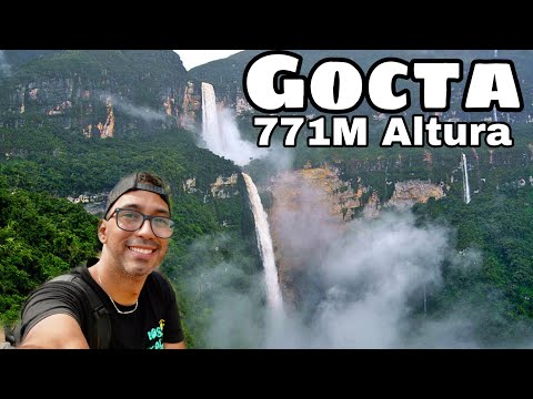 17:07
 2:39
 10:57
Chosen from YouTube; videos belong to their creators and play from YouTube's privacy-enhanced player.
Guidebook
Brendan Sainsbury et al. · 2025
Covers the Amazonas region around Chachapoyas, the base for the Gocta and Yumbilla hikes and Kuélap fortress.

Guidebook
Ben Box · 2017
The one-volume continental handbook, useful for multi-country trips that link falls such as Iguazú, Kaieteur and Angel Falls.
About 771 metres in two tiers: an upper drop of roughly 231 metres into a hanging basin, then a lower drop of about 540 metres. That places it among the tallest waterfalls in the world, though rankings vary between lists, depending on how they treat tiered falls. Nearby Yumbilla is taller again, at about 896 metres.
Yes. Peru's National Geographic Institute measured Yumbilla in 2007 at about 896 metres, compared with Gocta's 771. Yumbilla is split into several drops down a long cliff and usually carries less water, so Gocta tends to look more dramatic. The two are about half an hour apart by road near Pedro Ruiz.
From Cocachimba to the base of the lower tier is about 5.5 kilometres each way, 11–12 kilometres in total, and takes 4–6 hours return with a stop at the falls. The traverse from San Pablo, which visits both tiers and finishes in Cocachimba, is about 18 kilometres and takes a full day.
The community entry fee was S/ 15 (about $4.40) for the Cocachimba route and S/ 30 (about $8.80) for the full San Pablo–Cocachimba route in 2025. Horses cost about S/ 60–80 return. Guided hikes from Cocachimba run from about S/ 60–65, and colectivos from Chachapoyas cost around S/ 10 each way.
No. The Cocachimba trail is clear and busy enough to walk independently after paying the community fee in the village. A guide adds wildlife spotting and local knowledge, and is worth considering for the longer San Pablo traverse or in the wet season. Lodges and agencies in Chachapoyas offer guided day trips.
It runs Tuesday to Sunday, roughly 8 am to 5 pm, but it has had frequent interruptions: several rain and rockfall suspensions in January 2026 and a scheduled maintenance closure from 4 to 25 May 2026. Check telecabinaskuelap.com close to your date. Kuélap itself has been partly reopened since August 2023 after the 2022 wall collapse.
The quickest way is ATSA's direct flight from Lima to Chachapoyas, which runs every other day. LATAM flies Lima to Jaén, 3–4 hours away by road, and restarted the route in October 2025. Overland, overnight buses from Chiclayo take about 10–11 hours, and Tarapoto is 7–9 hours by road.
April to June is the best balance: the falls still carry plenty of water from the rains and the trails are drying out. July to September has the firmest paths but a thinner waterfall. October to March brings the most water, along with deep mud, cloud over the upper tier and more frequent road and cable-car closures.
Gocta Falls is in Peru (Amazonas). The nearest base is Cocachimba and the closest airport is CHH. Its coordinates are -6.0231, -77.8870.
Prices, fees and entry rules change. We re-check full guides regularly; spotted something out of date? Tell us.
Nearby
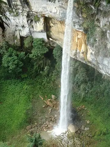
One of the five tallest waterfalls in the world

María Jiray is a man-made waterfall located at 3400 meters above sea level, near the town of Acopalca, in the…

The Agoyán waterfall is a waterfall on the Pastaza River outside of the tourist town of Baños de Agua Santa…

Pailón del Diablo is one of the most famous waterfalls in Ecuador, located near the town of Río Verde in the…