
Guidebook
Lonely Planet India
Lonely Planet · 2024
The 20th edition covers every state with a fall on this site, from Goa and Karnataka to Meghalaya and Chhattisgarh.

India · Kaimur district
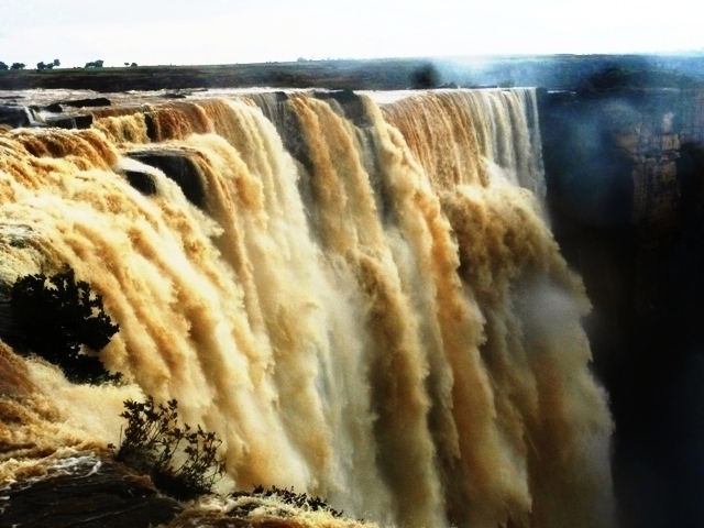
Telhar is the name of a waterfall located in the Kaimur district of Bihar, India. The fall is located close to the origins of Durgavati River.
Facts from Wikidata and Wikipedia, compiled September 2026; season and access are our estimate, not a visit report. How we build these pages.
Telhar drops over a series of steps on the Durgavati River. It is a cascade-type fall, and the nearest base for a visit is Kaimur district, India. Access to the main viewpoint is rated moderate.
Summary adapted from the Wikipedia article (CC BY-SA 4.0).
As a cascade waterfall, water tumbles down a series of rock steps rather than falling free.
No commercial adventures run at Telhar itself — the experience is the approach and the view. Guided day trips from Kaimur district are the easiest way to combine it with the area around it.
Also good forHikingPhotography
Monsoon-fed: flow builds from July and the falls are fullest, and usually safest to approach, from late August to November once the rains ease.
This waterfall
Telhar
India
Height—Width—
 Most similar
Hogenakkal Falls
India
Height20 mWidth—
Also a cascade waterfall and in India too
 Largest curtain
Victoria Falls
Zimbabwe · Zambia
Height108 mWidth1,708 m
Largest single sheet of falling water
 Tallest on earth
Angel Falls
Venezuela
Height979 mWidth—
 Widest on earth
Khone Phapheng Falls
Laos
Height21 mWidth10,783 m
Measured across the whole multi-channel system
We don't have a reliable crest width for Telhar yet, so it is left off the width chart. Tallest · widest lists.
Guidebook
Lonely Planet · 2024
The 20th edition covers every state with a fall on this site, from Goa and Karnataka to Meghalaya and Chhattisgarh.
24.83263, 83.53096
Telhar is in India (Kaimur district). The nearest base is Kaimur district, India. Its coordinates are 24.8326, 83.5310.
Peak flow is August to November. Monsoon-fed: flow builds from July and the falls are fullest, and usually safest to approach, from late August to November once the rains ease.
Beyond the viewpoints: hiking and photography. Access to the main viewpoint is rated moderate — a real walk — expect stairs, uneven ground or an hour on the trail.
The usual base is Kaimur district, India. A real walk — expect stairs, uneven ground or an hour on the trail from there.
Nearby

Karkat Waterfall is situated in the Karkatgarh Village, Kaimur Range in the Kaimur district of the Indian…

The Lodh Falls is a waterfall on the Burha River in the mid-forest of Palamau Tiger Reserve, in Latehar…

Lower Ghaghri Falls is located 10 kilometres from Netarhat in Latehar district in the Indian state of…
The Bahuti Falls is a waterfall in Mauganj district in the Indian state of Madhya Pradesh. It is the highest…