Lonely Planet Mexico (19th edition)Lonely Planet
Guidebook
Lonely Planet Mexico (19th edition)
Lonely Planet · 2025
Newest edition of the standard Mexico guide, covering Chiapas near Palenque, the Huasteca Potosina and Copper Canyon.

Mexico · San Luis Potosí, Huasteca Potosina
Cascada de Tamul
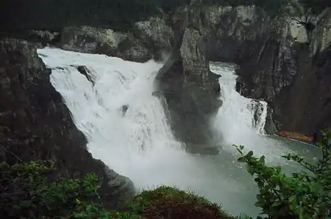
Two rivers, one running clear turquoise and one silt-laden, merge just above the lip and plunge together over a broad limestone cliff in Mexico's Huasteca Potosina region. Most visitors approach by dugout canoe up the Tampaón River, watching the two colors mix in real time before the drop.
Checked September 2026 by David Bussell
Tamul Falls drops 105 metres (345 ft) on the Santa María / Tampaón. It is a block-type fall, and the nearest base for a visit is Tanchachín, with SLP the closest airport. Access to the main viewpoint is rated moderate.
Tamul Falls is the third-tallest of the 12 we cover in Mexico. As a block waterfall, a wide sheet of water falling from a broad river.
Also good forBoat cruisesHikingPhotography
Post-rainy season (Oct-Jan) gives full flow and clear turquoise water before the dry season thins it.
Entry: Community boat tour fee ~$15-20 USD
 This waterfall
Tamul Falls
Mexico
Height105 mWidth—
 Most similar
Virginia Falls
Canada
Height96 mWidth—
Also a block waterfall, of similar height and in Canada
 Largest curtain
Victoria Falls
Zimbabwe · Zambia
Height108 mWidth1,708 m
Largest single sheet of falling water
 Tallest on earth
Angel Falls
Venezuela
Height979 mWidth—
 Widest on earth
Khone Phapheng Falls
Laos
Height21 mWidth10,783 m
Measured across the whole multi-channel system
Angel Falls is 9.3× taller than Tamul Falls. It is about the same height as Victoria Falls (108 m). We don't have a reliable crest width for Tamul Falls yet, so it is left off the width chart. Tallest · widest lists.
 3:21
 18:13
Chosen from YouTube; videos belong to their creators and play from YouTube's privacy-enhanced player.
Guidebook
Lonely Planet · 2025
Newest edition of the standard Mexico guide, covering Chiapas near Palenque, the Huasteca Potosina and Copper Canyon.

About this place
Margaret Hooks · 2006
Story of the surrealist jungle garden at Xilitla, the Huasteca's other big draw and an easy pairing with Tamul.
21.8013, -99.18
Tamul Falls is in Mexico (San Luis Potosí, Huasteca Potosina). The nearest base is Tanchachín and the closest airport is SLP. Its coordinates are 21.8013, -99.1800.
Tamul Falls drops 105 metres (345 feet). It is a block-type waterfall on the Santa María / Tampaón.
Peak flow is January and October to December. Post-rainy season (Oct-Jan) gives full flow and clear turquoise water before the dry season thins it.
Beyond the viewpoints: swimming, boat cruises, hiking and photography. Access to the main viewpoint is rated moderate — a real walk — expect stairs, uneven ground or an hour on the trail.
Yes — swimming is a normal part of a visit to Tamul Falls, in the pools away from the falling water. Only swim where it is permitted on the day, stay clear of the base of the falls where currents recirculate, and skip it after heavy rain.
The usual base is Tanchachín, and the closest airport is SLP. A real walk — expect stairs, uneven ground or an hour on the trail from there. Community boat tour fee ~$15-20 USD.
Nearby

The Basaltic Prisms of Santa María Regla are tall columnar joints of basalt rock near Huasca de Ocampo in the…

Cola de Caballo is a waterfall about 25 m , in the town of Villa de Santiago, Nuevo León. It is open to the…

El Salto is a rock climbing area in the Nuevo León, Mexico. The climbing area is near to Ciénega de González…

Juanacatlán Falls is a waterfall on the Santiago River in the Mexican state of Jalisco, once known as the…