
Guidebook
Lonely Planet Norway
Lonely Planet · 2024
Current Lonely Planet covering the western fjords, Hardanger, Geiranger and Telemark roads past Norway's big falls.

Norway · Flora Municipality
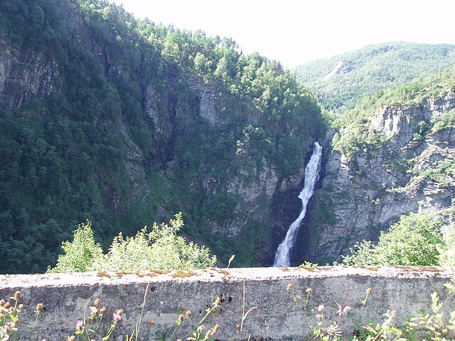
Brudesløret is a waterfall in Haukå which is located in Kinn Municipality in Vestland county, Norway. It is located near Norwegian county road 614, just north of the Norddalsfjorden.
Facts from Wikidata and Wikipedia, compiled September 2026; season and access are our estimate, not a visit report. How we build these pages.
Brudesløret drops 110 metres (361 ft). It is a horsetail-type fall, and the nearest base for a visit is Kinn, Norway. Access to the main viewpoint is rated moderate.
Summary adapted from the Wikipedia article (CC BY-SA 4.0).
As a horsetail waterfall, water stays in contact with the rock as it falls.
No commercial adventures run at Brudesløret itself — the experience is the approach and the view. Guided day trips from Kinn are the easiest way to combine it with the area around it.
Also good forHikingPhotography
Snowmelt feeds the falls from late May; June to August is the short, bright season, and many access roads close in winter.
 This waterfall
Brudesløret
Norway
Height110 mWidth—
 Most similar
Steall Falls
United Kingdom
Height120 mWidth—
Also a horsetail waterfall, of similar height and in the United Kingdom
 Largest curtain
Victoria Falls
Zimbabwe · Zambia
Height108 mWidth1,708 m
Largest single sheet of falling water
 Tallest on earth
Angel Falls
Venezuela
Height979 mWidth—
 Widest on earth
Khone Phapheng Falls
Laos
Height21 mWidth10,783 m
Measured across the whole multi-channel system
Angel Falls is 8.9× taller than Brudesløret. It is about the same height as Victoria Falls (108 m). We don't have a reliable crest width for Brudesløret yet, so it is left off the width chart. Tallest · widest lists.
Guidebook
Lonely Planet · 2024
Current Lonely Planet covering the western fjords, Hardanger, Geiranger and Telemark roads past Norway's big falls.

Guidebook
DK Eyewitness · 2024
Illustrated Norway guide, good for planning fjord drives such as Geiranger and Hardanger.
61.64287, 5.28742
Brudesløret is in Norway (Flora Municipality). The nearest base is Kinn, Norway. Its coordinates are 61.6429, 5.2874.
Brudesløret drops 110 metres (361 feet). It is a horsetail-type waterfall.
Peak flow is June to August. Snowmelt feeds the falls from late May; June to August is the short, bright season, and many access roads close in winter.
Beyond the viewpoints: hiking and photography. Access to the main viewpoint is rated moderate — a real walk — expect stairs, uneven ground or an hour on the trail.
The usual base is Kinn, Norway. A real walk — expect stairs, uneven ground or an hour on the trail from there.
Nearby

Kvinnefossen is a waterfall of the river Kvinna in Sogndal Municipality in Vestland county, Norway. County…

Ramnefjellsfossen is unofficially listed as the third-highest waterfall in the world in several publications.…
 UNESCO
Centerpiece of the UNESCO-listed Geirangerfjord
Stalheimsfossen is a waterfall located in the village of Stalheim in Voss Municipality in Vestland county…